christina

Leaning towers of Santos

About 80 km from Sao Paulo, Santos has the biggest seaport in Latin America and it is from here that we board our transatlantic cruise.  So it made sense to spend our last few days in this area, even though we had been warned this was not the nicest tourist destination.

Santos is known for being the country’s coffee exporting capital and home of Pele, the legendary Brazilian soccer star who played most of his career here. The 100,000-plus seat stadium that dominates Santos’ skyline is regarded as much a shrine as the city’s historic Coffee Exchange, now a museum, where farmers once haggled with barons over the price of their crop.

As possibly the only foreign tourists in this city of about half a million, we enjoyed being immersed in the local culture, a little off the beaten tourist track.  We joined the many locals who headed to the beach in droves on Saturday and Sunday, although we did stand out in our beach attire.  I simply could not convince Chris to buy a speedo, the standard for all males regardless of age and physique. Contrary to common belief, not all women wore skimpy micro bikinis, in fact they were in the minority. Much to my surprise (and perhaps Chris’ disappointment), most wore rather modest bikinis.  Things might be different when we get to Rio.

Our hotel, Ibis, was ideally situated about 50 m from the beach giving us quick and easy access. The beach was long and wide, with a 5 km beachfront garden that made it in the Guinness Book of Records as the largest beachfront garden in the world.  We joined runners of all shapes and sizes for two morning runs along the firm sand at the water’s edge.  What a fabulous running route!

Setting up for the day.  Each weekend morning, vendors set up
their chairs and umbrellas along with a mini bar to serve their clients.

Packing up at the end of the day.

The beach cleared out by dusk, but as night fell, the beach was illuminated
by large flood lights; we saw people strolling along the beach
(from out hotel window) well into the night.

Taking a stroll in the early evening,
watching the cruise ships sail away into the sunset.

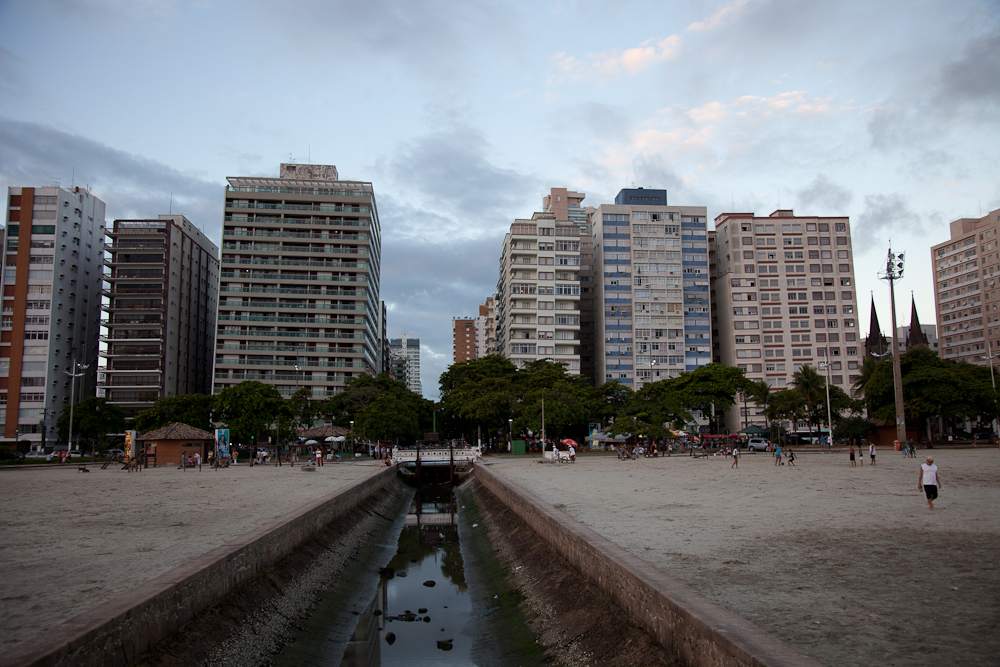
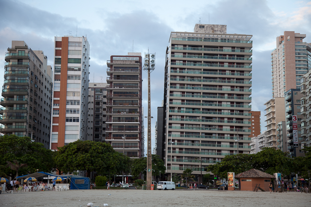
While walking along the beach, we noticed a strange phenomenon – many of the buildings appeared to be leaning.  At first we thought it might be an optical illusion, but on closer scrutiny, we confirmed these buildings were definitely leaning. I later learned that the problem became manifest back in the 40’s, 50’s and 60’s and is the result of a combination of poor soil conditions and shoddy workmanship. Below a seven-meter layer of sand is a 30-40 meter deep bed of clay that doesn’t cope well with the weight of the structures. Almost 100 buildings have been affected, all of which are inhabited, and which authorities are quick to assure are completely safe.   Some speculate that if one building were to collapse, it could trigger a domino affect that could literally wipe out the beach front. It is possible to correct these structural problems but the cost is prohibitive; only one building has been repaired thus far at a cost of over half a million dollars.

We arrived in Santos with back packs full of dirty clothes; we were in desperate need of doing laundry.  While travelling for six months in South America, laundry services have been available on practically every street corner. But now, when we were in desperate need, not one could be found. There were plenty of dry cleaners around our upscale neighbourhood, but not a single laundry service.  And so we washed our clothes by hand in our hotel sink and made some makeshift clothes lines to dry them out.  Not ideal, but at least we had clean clothes before our cruise.

Today, we are boarding our ship, Costa Fortuna, and we will most likely be off line for the next three weeks.  If that cruise line sounds familiar, it’s probably because you’ve read about some cruise related accidents in the news recently.  The ship that went aground off the coast of Italy in January was part of Costa’s fleet as was the one that drifted for days close to the Seychelles Islands in the Indian Ocean because a fire killed all electrical power on board.  We’re keeping our fingers crossed that this ship will sail without incident and we’ll make it across the pond in one piece.

Here’s our itinerary:

Mon 3/19 Santos (Brazil)
Tue 3/20 Rio de Janeiro (Brazil)
Wed 3/21 At Sea - -
Thu 3/22 Ilheus (Brazil)
Fri 3/23 Salvador Bahia (Brazil)
Sat 3/24 Maceio (Brazil)
Sun 3/25 Recife (Brazil)
Mon 3/26 Fortaleza (Brazil)
Tue 3/27 At Sea - -
Wed 3/28 At Sea - -
Thu 3/29 At Sea - -
Fri 3/30 At Sea - -
Sat 3/31 At Sea - -
Sun 4/1 St. Cruz de Tenerife (Canary Islands)
Mon 4/2 At Sea - -
Tue 4/3 Malaga (Spain)
Wed 4/4 At Sea - -
Thu 4/5 At Sea - -
Fri 4/6 La Valletta (Malta)
Sat 4/7 Corfu (Greece)
Sun 4/8 Dubrovnik (Croatia)
Mon 4/9 Venice (Italy)

See you in three weeks in Italy!

Scratching the surface of São Paulo

With a population of 11+ million in the city and almost 20 million in its metropolitan region, to say São Paulo is big would be an understatement.  In fact, São Paulo is the largest city in Brazil, the largest city in the southern hemisphere and America, and the world’s sixth largest city by population. We spent four days in São Paulo and barely scratched the surface of this vast city.

Our hostel, Telestar was located in the Vila Mariana neighbourhood, and was well situated within a few minute walk to the metro, which was our primary means of transportation as we explored various parts of the city.  This hostel catered to a younger crowd of primarily solo, male travellers, many of whom were working in the city. Like every hostel, there were things we liked and things we didn’t like. I found the level of cleanliness to be seriously lacking, we didn’t have wifi in our room, and the general atmosphere was more of a frat house than a commercial hostel. The best part of our stay was the food. Breakfasts included freshly squeezed orange juice, delicious brewed coffee, fresh fruit, and a choice of ham omelette or melted cheese and ham sandwich.  Dinner was provided by the resident chef who prepared delicious meals each night that represented typical Brazilian cuisine.

Posing with the chef at our hostel.

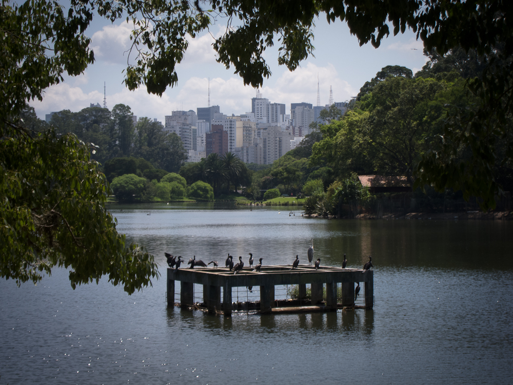
The second largest park of the city and probably the most popular, Ibirapuera Park was within walking distance from our hostel. Reminiscent of Central Park in New York City in terms of its location in the middle of a city, its size and its beauty, we visited the park twice – the first time for a touristy run (run, take pictures, walk, take more pictures, visit the art gallery, run a little more, etc.), and the second time for a real run.

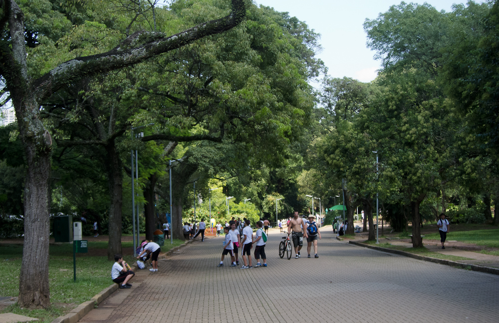
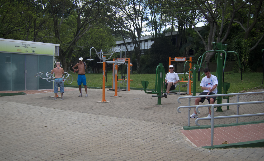
A large main roadway (closed to traffic) provided a perfect running track as it passed around two man-made lakes that were home to black and white swans along with a variety of other birds.  A choreographed water fountain entertained us for almost an hour, reminding us of the water fountain in front of the Bellagio Hotel in Las Vegas. The park features several pavilions, museums and galleries; we visited the Afro-Brazil Museum which honored Brazil’s rich African heritage. Both times, we visited the park mid-morning in the middle of the week and it was full of people engaged in all forms of physical fitness: walking, running, cycling and exercising in the many exercise stations located throughout the park.  Paulistanos, as residents of São Paulo are known, take exercising seriously!

Choreographed water fountain.

Exercise station in the park.

Video:  Dancing waters

We discovered Parque Trianon while walking along Paulista Avenue, which was in the heart of the downtown financial district. This small park was a  tropical oasis in the middle of the city, offering a lovely escape from the traffic, noise and pollution.  In fact, while walking through this jungle-like park, one could easily forget that you were in the middle of a city since even the buildings were obscured by the thick vegetation.

Architecture along Paulista Avenue.

The Liberdade neighborhood is home to the largest Japanese population outside of Japan and we spent one day wandering through this area and the neighbouring Centro district.  It was here that I decided to do a little bit of shopping in preparation for our cruise and trip to Italy. And it was here that I faced head on the challenge of not knowing a single word of the local language, Portuguese.   How to ask for another size, or a different color?  The majority of the boutiques were staffed with zealous assistants who made it their mission to help you.  As I entered a boutique, I would be greeted by one of the sales staff who would ask me, I assume, if she could help me find something.  I immediately said I spoke no Portuguese, only English.  Nobody spoke English.  Undeterred, the assistant would stay by my side, making suggestions even though I didn’t understand what she was saying, holding any clothes that I wanted to try on.  Somehow I managed with a creative use of sign language and facial expressions to find the things I was looking for: a pair of high heels, dress pants and a dressy top. It was exhausting!

Centro district in Sao Paulo.

Metropolitan Cathedral

View of the plaza from the cathedral steps.

Shopping in downtown Sao Paulo.

As we walked around the city, we wondered why there were no billboards or advertisements anywhere to be seen.  Apparently, the city passed a Clean City Law in 2007 which resulted in the removal of about 15,000 billboards, 1,600 signs and 1,300 towering metal panels. This law even extends to the air space above São Paulo.  The goal of this law was to remove “visual pollution”, which resulted in exposing both the beauty and ugliness of Brazil’s bustling business capital. For the first time in decades, the ornate facades of old downtown buildings have been revealed in all their glory; on the other hand, the slums, or favelas, that line the expressways are no longer hidden behind gaudy billboards.

In spite of its formidable size and reputation as a dangerous city, São Paulo made a favourable impression on us.  The areas we explored were extremely clean, probably the cleanest South American city we have visited, and we always felt very safe.  Police presence is strong throughout the city which has gone a long way towards curbing petty crimes.  The extensive metro system was modern, clean and air conditioned.  Brazilian cuisine was delicious; no matter where we ate, we always had a great meal.  The people were friendly and helpful despite our lack of basic language skills.  All in all, we enjoyed our few days in Sao Paulo, even though we know we barely scratched the surface.

Getting to Iguazú Falls in style

Much to my great dismay we arrived in Iguazú Falls a full hour ahead of schedule.  This meant one hour less on the most luxurious bus I’ve ever been on.  Perhaps I’m being a little facetious, but I’m not kidding about our very enjoyable 17 hour bus ride from Buenos Aires to Puerto Iguazú (Bus company: Via Bariloche, Full Cama Service, if anybody is planning a trip).

Each pair of seats was ensconced in its own cubicle, complete with individual television monitors that offered a range of videos and music to entertain, and plush red leather seats that were more comfortable than our Lazy-Boy recliners at home and these seats fully reclined into a perfectly horizontal position.  We were issued cozy fleece blankets and pillows.  The only thing missing was a remote control which really would have been handy when you were fully reclined, but my toes provided a suitable alternative, much to Chris’ amusement.

I’m not sure what you call the guy tending to all our needs; I’ll call him our butler although he looked more like an airline pilot in his smart uniform, but he acted in a very suave manner much like I would imagine a butler would act.  (Maybe I’ve been reading too much fiction lately.)   We knew we were in for a treat when our butler offered us an array of candies as soon as we sat down.  They don’t do that on the buses in Ecuador!

Once we were on the road, dinner was served – salad, bread, and a delicious hot meal (beef casserole with mashed potatoes), and of course dessert.  We had our choice of refreshments including wine.  Coffee and biscuits were served after dinner, followed by a shot of Irish whiskey.  We all slept like babies throughout the night. The next morning we were greeted by our ever friendly and obliging butler who served us coffee and a typical South American breakfast of croissants along with white bread and jam. Doesn’t this sound like a civilized way to travel?  Now do you understand why I didn’t want to get off the bus, especially an hour earlier than scheduled?  I’m sure we are ruined for all future bus travel.  It’s just as well we’re leaving South America soon.

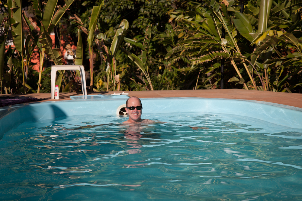
The first thing we noticed about Puerto Iguazú was the heat.  The relentless sun beat down on us without a hint of a breeze to offer any relief.  It was almost unbearable.  We were drenched in sweat when we arrived at our hostel, just a short three block walk from the bus station.  But what a delight to discover our hostel (Garden Stone in case you’re looking for a place in Puerto Iguazú ) had a pool – something that saved us each day.  A funny thing about our hostel:  our room was very small and right next to the office so rather noisy, the bed was terribly uncomfortable, the breakfast was mediocre at best – yet we loved our time there and wished we had booked an extra night or two.

Our hostel felt like a mini resort or a friend’s back yard.

Behind the hostel was a lush, tropical garden, complete with hammocks in the shade, garden chairs, the pool, and a lovely open air, common kitchen and dining area. At the end of each day, guests would hang out around the pool, getting to know each other, sharing where they’ve travelled and where they’re going next. It was here we met Russ who was one year into a two year journey.  He had walked the Camino de Santiago last June – something we are planning to do this June. I had never met anyone who had done this walk before so naturally I peppered him with questions about his experience and am now even keener than ever to do this pilgrimage.  Yet, I still can’t answer the simple question, why?  I just feel I want to, maybe even need to do it.

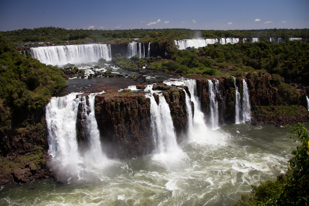
I digress from the main purpose of our trip to Puerto Iguazú which was, of course, to visit Iguazú Falls, the second largest waterfalls in the world (Victoria Falls in South Africa are the largest and Niagara Falls in Canada are a very distant third).  Declared a Natural World Heritage Site by UNESCO in the early 1980’s, these falls are comprised of 275 individual falls spanning three kilometres. cascading up to 70 m into a giant gorge amidst a lush, subtropical rainforest.   Its normal flow is about 1.3 million litres per second.  The falls straddle both Argentina and Brazil; catwalks are built on both sides providing closer (often times mistier and wetter) views of this impressive waterfall. On November 11 of 2011, Iguazú Falls was declared to be one of the seven winners of the New7Wonders of Nature by the New Seven Wonders of the World Foundation.

Igauzu Falls MapMap of the walking trails and boat routes (red dots) on the both sides of the falls.
The island in the middle, San Martin, was closed to the public the day we were
there because a film crew was shooting a movie at that location. 

We spent one day on the Argentine side and one day on the Brazilian side.  We were relieved that our Brazilian Visas passed the scrutiny of the immigration officials.  These were the visas we had obtained in La Paz, Bolivia (doesn’t that seem like ages ago?) and we always wondered, and maybe worried a little if we would have any problems with them since they had been produced so quickly, and in a third world country no less.

Lookout from the Brazilian side of the falls.

Close up of the falls.

Rainbow at Devil’s Throat (La Garganta del Diablo)
as seen from the Argentine side.

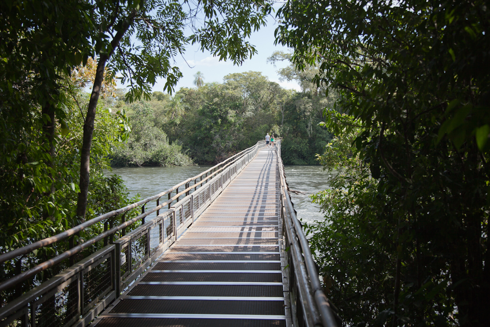
An impressive network of walkways often passed right over
the water as it spilled over the very edge of the waterfall. 

The view from the Brazilian side – note that these are just
some of the falls.  It was impossible to capture it all
in a single photo! 

Contrary to what most people say, I think the Brazilian side of the falls was just as stunning as the view from the Argentine side, it just offered a different perpsective.  The Brazilian side offered a panoramic view that helped you appreciate how large these falls were.  From the Argentine side, one feels and hears the thunderous power of the falls more intimately.

Another view from the Brazilian side.

My favourite lookout on the Argentine side.  I felt very small
next to these powerful falls – and I was only standing at the
mid-point – half the falls were still below me. 

Chris and I at the same lookout as above.  Can you believe
we had the lookout to ourselves – well, at least for about
thirty seconds! 

View from the Argentine side from the upper walkway.

A great view from the Brazilian side.  
Devil’s Throat is in the background. 

My favourite view from the Brazilian side plus we got
soaked from the spray which cooled us off nicely. 

Another shot from the Brazilian side.

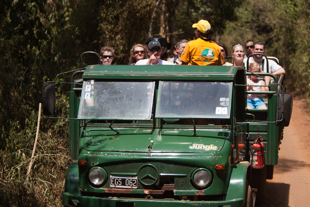
We succumbed to the lure of a tour offering a grand adventure under the falls.  Very much like the “Maid of the Mist” tour in Niagara Falls, this tour brings you by boat very close to the falls, even dunking you under a few times just for the thrill of it.  This was followed by a quick ride down the river through some fast moving water that they called “exciting rapids” (hardly!) after which we were transported by open truck through eight kilometres of rainforest during which we saw absolutely no wild life, not even a bird (contrary to the brochure’s promises of encounters with exotic wildlife like orangutans).  It was all over in less than an hour.  I think the best part was getting completely drenched and thoroughly cooled off; otherwise, it was really just another cheesy tourist attraction that we got suckered into. When are we going to learn?

No animals on this “jungle tour” which was quite ridiculous
when we encountered wildlife just walking through the park.
A few samples are below.

Video:  Experience the power and force of Iguazú falls with us.


The sights and sounds of Buenos Aires

Our time in Buenos Aires has passed by far too quickly.  We are spending our days wandering around the various neighbourhoods and visiting some of the tourist sites, walking endlessly. I discovered the Reserva Ecologica which is a beautiful ecological park about 2km from our apartment and a perfect place to go for a run.

Speaking of our apartment, we are staying in a 2 bedroom walk up (3rd floor) in San Telmo, the oldest, most historical district in Buenos Aires.  Our apartment could best be described as shabby chic, with a bohemian twist, very reflective of this neighbourhood.  I must admit that as each day passes, both the apartment and neighbourhood look a little more shabby than chic, but that’s the real Buenos Aires experience. One of the best features of the apartment is its location; not only is it in a trendy, hip neighbourhood, but it is within walking distance to most tourist attractions and other equally trendy and interesting neighbourhoods like La Boca and Micro-centro.  While a bit of a hike, Ricoleta and Palermo are also within walking distance, although much easier and faster to reach by subway (when it is running that is – it was closed at least once because of striking workers).

Hanging out in the apartment. We’ve really enjoyed the space
and the location.  Aside from an infestation of ants in the kitchen
(gross!) and a roof that leaks like a sieve when it rains,
it’s been a great place from which to explore the city. 

The Paris of South America

Buenos Aires is aptly nicknamed the Paris of South America with its large, tree-lined boulevards, European style architecture, elite shopping districts and a rich cultural heritage.  This city reminded us of Havana, Cuba, the French District in New Orleans as well as New York City.  Home to hundreds of bookstores (one such gem in our neighbourhood, Walrus Bookstore, is devoted entirely to English literature), public libraries and cultural associations (it is sometimes called “the city of books”), as well as the largest concentration of active theatres in Latin America. I was disappointed to learn that the new season of the Teatro Colón, an internationally rated opera house, was beginning on March 8th, the day after we leave.  The theatre district was reminiscent on a small scale of Times Square and the theatre district in New York City.

Typical city  bus – rather vintage looking!

The Obelisk in the centre of Avenido 9 de Julio – a busy, 20 lane
boulevard (I counted) that was tricky to get across. 

Avenido 9 de Julio, near the Obelisk.

To the side of the Plaza de Mayo, where people gather to demonstrate about
anything and everything.  Since being the scene of the 25 May 1810
revolution that led to independence, the plaza has been a hub of
political life in Argentina. 

Typical architecture.

The Obelisk near the end of the day.

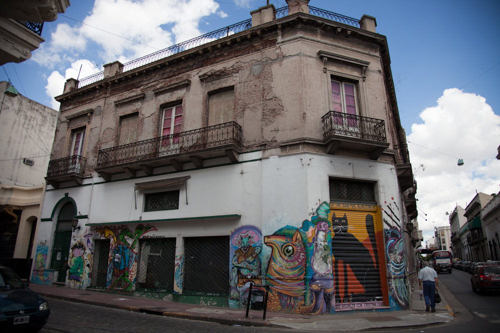
Grafitti is common place.  We actually saw a guy on our
street walking along with a can of black spray paint.
Every now and then he stopped and tagged a wall. 

San Telmo neighbourhood where crumbling old buildings
stood alongside newer ones.  This is the area we stayed in.

The old architecture and tree lined streets and plazas
made walking around the city a real delight. 

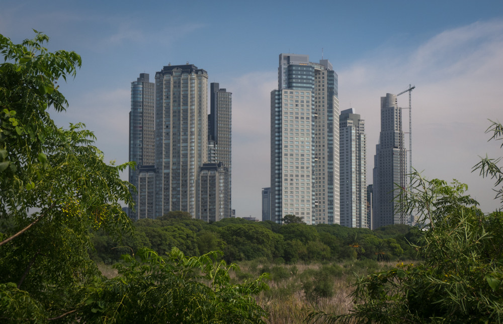
View of modern buildings from La Reserva Ecologica.

Waste management and recycling are handled rather
strangely here.  Garbage is put out on the street, and people
rummage through looking for recyclable materials (plastic,
 cardboard, glass).  The garbage is then left in a messy pile as shown above. 

An art exhibit at The Recoleta Cultural Centre.

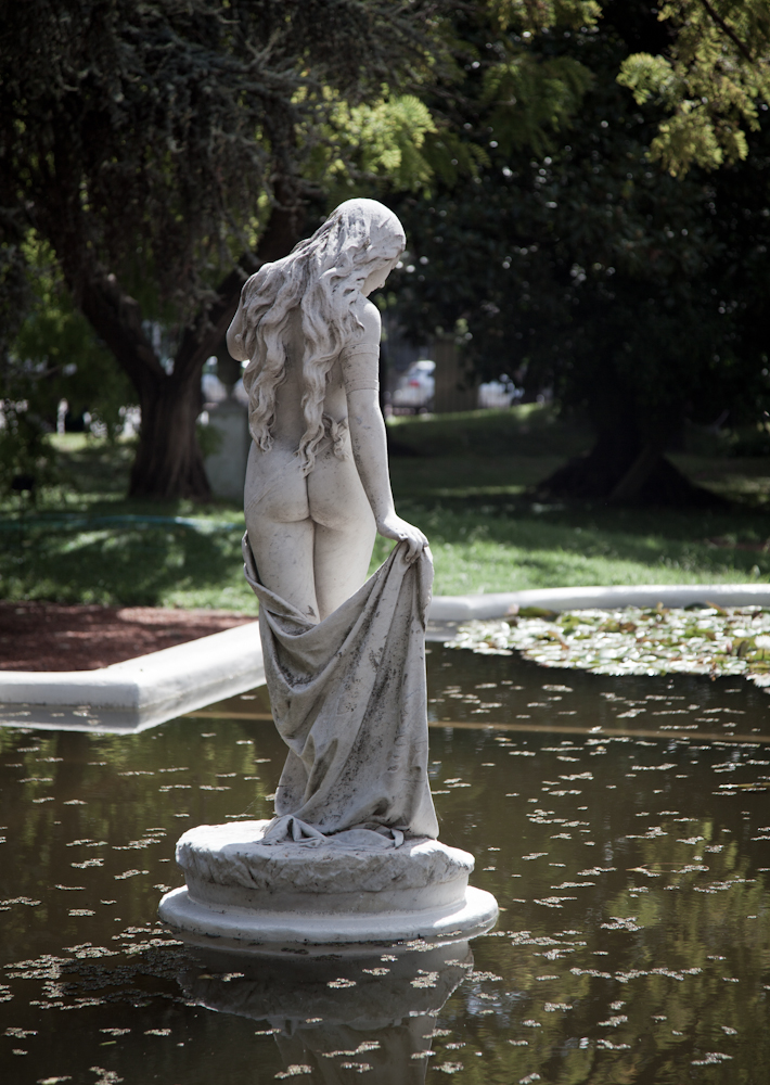
One of many statues in the Botanical Gardens.

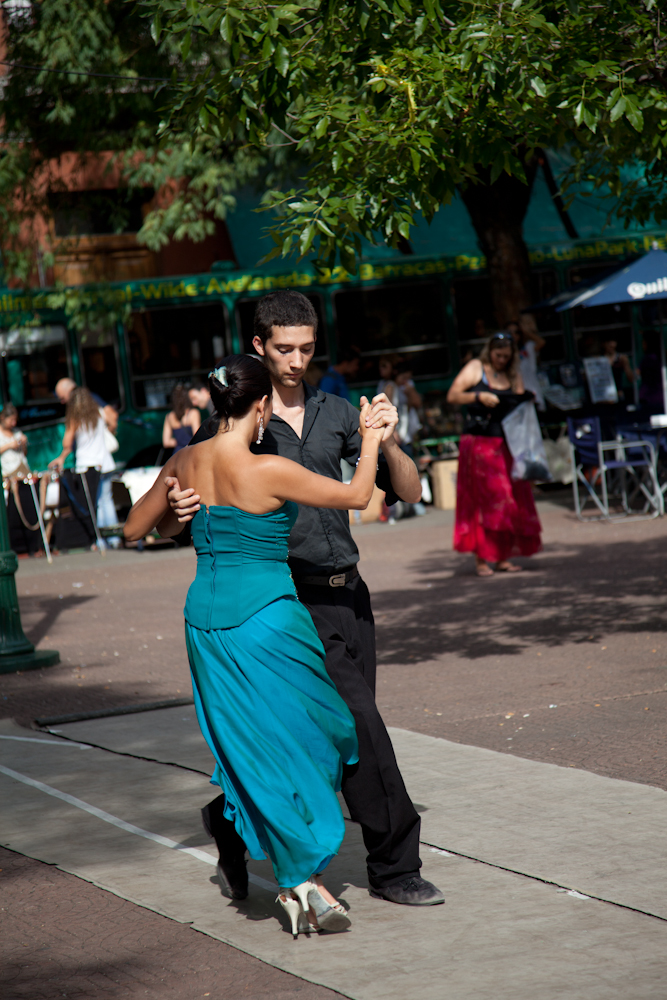
Tango music’s birthplace is in Argentina and reminders of this are everywhere, from the artwork sold in the markets, to the tango dancers on the street corners.

There was no shortage of things to do each day. Perhaps because we had two weeks to explore, or maybe we’ve just become used to a slower pace, we explored the city leisurely. We shifted our clocks to more closely align with the Argentine lifestyle, getting up late and going to bed equally late. A typical day began with us waking up around 10:00 am (unheard of for us!), followed by some coffee and breakfast at the apartment. We lounged around each morning, reading, surfing the net, researching and making bookings for upcoming journeys. We headed out in the early afternoon and usually stopped into a cafe for lunch around 2:30 or 3:00 (very typical time for lunch).  One day, we wandered into a restaurant which we were lucky to find open at 5:00 pm and were welcomed for lunch without question.  That’s damn near dinner time in Canada! Restaurants are usually closed between 4:00 and 8:00 pm when they re-open their doors for the dinner crowd which doesn’t really get going until 10:00 or 11:00 at night. Our usual bedtime was around 1 or 2 in the morning.  Quite remarkable for us!

The local beer on the counter at the apartment. Refreshing!

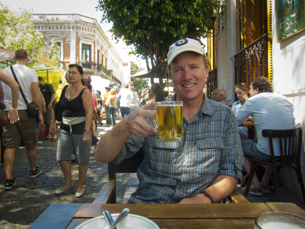
Enjoying a pint of “chopp” (draft) on a patio in San Telmo.

Eating out on patios reminded us of summertime in the
market in Ottawa. 

Wouldn’t we look good in this little darling?

San Telmo Market:  Every Sunday, just two blocks from the
apartment, La Defensa is closed to traffic and is transformed
into one great, big outdoor market full of antiques,
tacky souvenirs, artwork, jewellery, clothes, etc. 

Soda bottles for sale at the San Telmo market.


The market in La Boca was so touristy,
it looked more like a set for a movie rather than
an authentic neighbourhood.

More of La Boca.  We hated how contrived this neighbourhood was
and didn’t spend much time there as a result.

 Fruterias were on practically every corner and offered
a great selection of fresh fruits and vegetables
at reasonable prices.

Florida street, a popular outdoor pedestrian mall.
This place was bustling during the week but
on the weekend it was dead (reminded me of
Sparks Street in Ottawa).

Professional dog walkers were a common sight.  This
crew sat quietly waiting for the walker to return. 

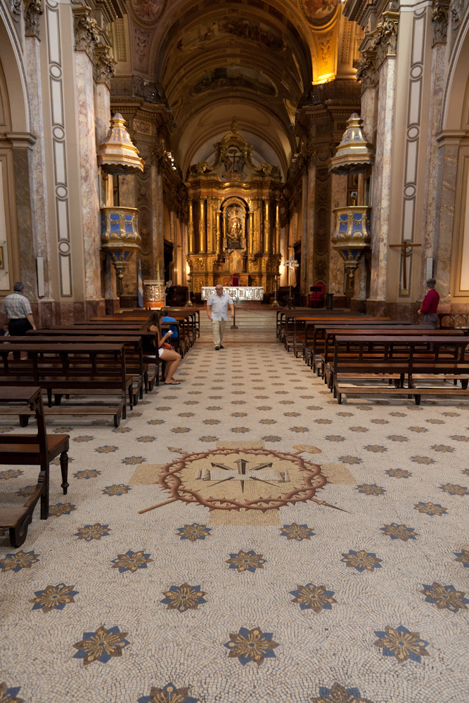
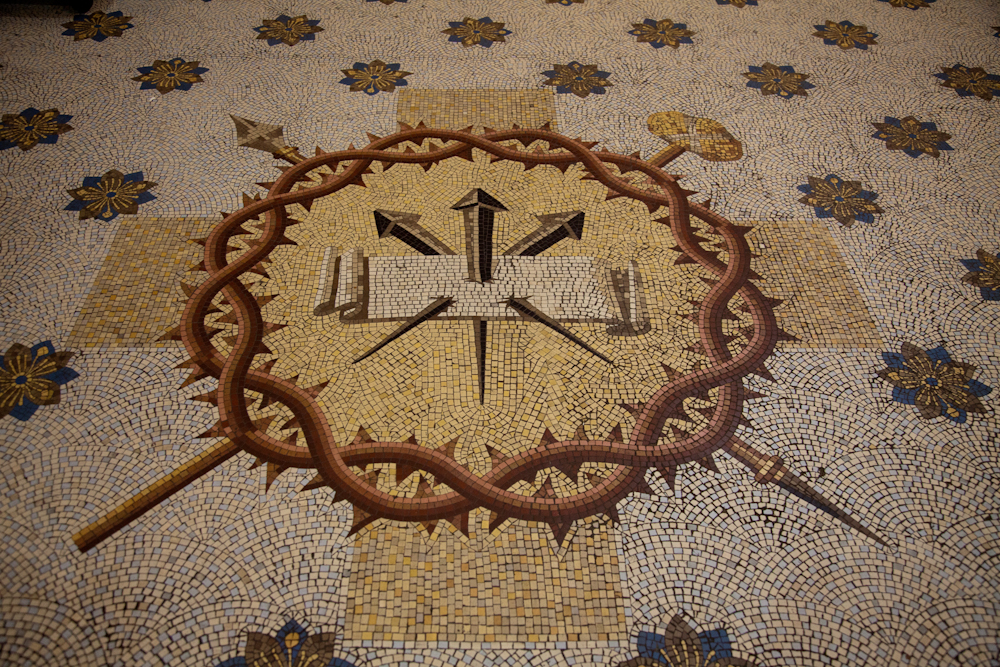
The entire floor of the Metropolitan Cathedral was done 
in mosaic tiles.  It was absolutely stunning.

La Recoleta Cemetery contains the graves of notable people, including 
Eva Perón, Raúl Alfonsín, and several presidents of Argentina.

Set in 5.5 hectares (14 acres), the cemetery contains 4691 vaults, all above ground,
of which 94 have been declared National Historical Monuments
by the Argentine government and are protected by the state.

Evita’s family tomb.  Her body was finally laid to rest here
after many years of controversy and a period of interment in Spain. 

View inside one of the vaults at the cemetery.

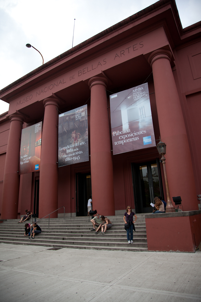
The Museo Nacional de Bellas Artes is home to  a permanent collection
that includes 688 major works and over 12,000 sketches,
fragments, potteries and other minor works.  

A little bit of history

The Casa Rosada (Pink House) is the building from which Eva Peron made her emotional speeches to her adoring fans in the 40’s and early 50’s. Today, it is home to the offices of the current president, Cristina Fernández de Kirchner, who arrives by helicopter each morning during the week.  I must admit, I had a foggy recollection of who Eva Peron was and felt it worthwhile to research  this iconic figure in more detail.

The President’s Office. It seemed strange that they opened up
her office to the public each weekend even allowing us to take pictures.

Changing of the guard in front of La Casa Rosada.

A visit to the Eva Peron Museum offered a fairly accurate picture of this remarkable and controversial woman’s life story – a modern day rags to riches fairy tale.  In her short life (she died of cancer at the age of 33), she was a successful entertainer (radio, theatre and film) who then met and married a rising political figure, Juan Perón. When her husband became president shortly after their marriage, she decided not to assume the traditional role of a president’s wife. It was at this time that she began to call herself Evita.  She became a tireless advocate for the poor and disadvantaged classes.  A woman ahead of her time, she worked alongside her husband the President, rather than in a more submissive, supporting role.  It was largely due to her efforts that women won the right to vote.  She is an iconic figure in Argentine history and was adored by the masses, and hated by the elite.  Even after her death, controversy continued, and it took many years before her embalmed body was finally put to rest in her family’s vault in Recoleta Cemetery here in Buenos Aires.

Interesting art on the side of an apartment building – a tribute to Evita.

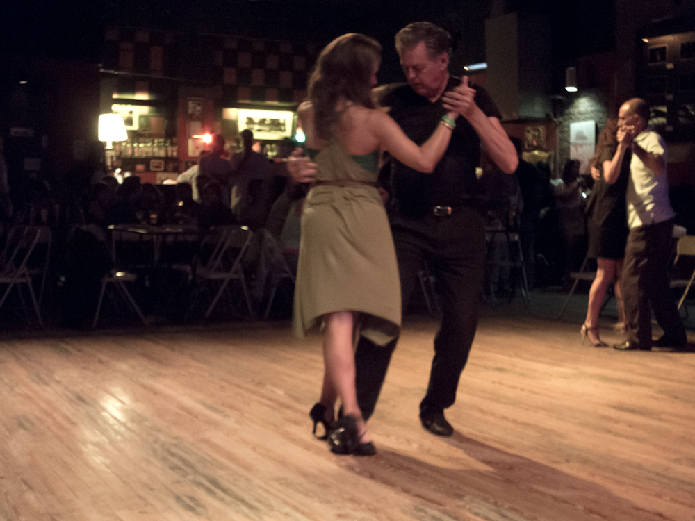
A local milonga just around the corner 

It was midnight last Wednesday night and things were just heating up as the sultry sounds of the live band enticed couples onto the dance floor to tango. Those dancing were of all ages and abilities, a blend of locals and tourists.  It was mesmerizing to watch the language of tango expressed by some of the better dancers, the nuances and subtlety of their moves, the fancy footwork, and the perfect harmony between dancers and the music.  As we sipped our wine, careful not to make eye contact with anyone lest someone might think we wanted to dance (such are the rules of a milonga), I felt transported back in time and place and was completely lost in the magic of the evening.

Video: Professional tango dancers

Video: Amateur tango dancers at a local milonga.

This milonga, a term for a place or an event where tango is danced, was the Argentine experience we were looking for in contrast to the contrived tango shows advertised on the streets and targeted to tourists. Throughout the evening and well into the early morning hours, we listened to the band play several genres of music, in the typical milonga format of four songs in a row followed by a short break. We shared our table with Grisela who had arranged the evening and another couple, Stuart and Vanessa who were from Australia/New Zealand.  And no, in case you were wondering, we did not take to the dance floor.  Porteños, as locals are called, take their tango dancing quite seriously and while dancers of all abilities are welcome on the dance floor, it is definitely not the place for beginners or non-dancers such as ourselves.

Video: The Milonga Band.

Something a little louder and hipper

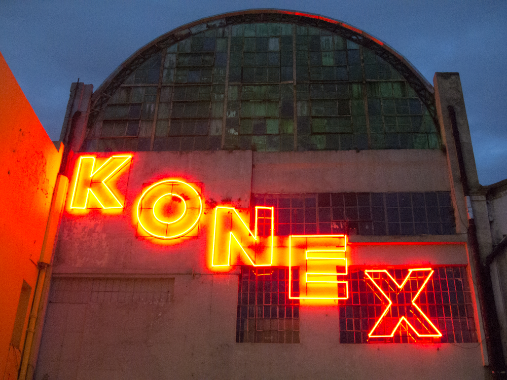
What a contrast the above-mentioned Milonga was to the show we enjoyed on Monday night at the Ciudad Cultural Konex, which hosts a weekly percussion extravaganza called La Bomba del Tiempo in an old oil factory. In the summer months, the show is held outside except if it rains, as was the case last Monday night, when they quickly reorganize everything onto a stage indoors.  The pre-show (a group of energetic, lively drummers) begins just after 7:00 pm, the main band takes the stage around 8:00 and it all wraps up around 10:00, just in time for dinner, Argentine style.

Although surrounded by a much younger, hipper crowd of both tourists and locals, we had a lot of fun listening to and watching this band perform.  The band’s leader directs the group through a series of intricate hand signals that was quite fascinating to watch.  Somehow we ended up near the front and centre, right in the middle of the party where the wildest dancing was taking place.  This was the closest I had ever come to being in a mosh pit – just crazy!

Videos:  La Bomba de Tiempo

Dining delights

Beef is a mainstay of Argentine cuisine and we were determined to get our fill.  Reputed to be some of the most tender beef in the world, probably because of the grass based diet versus grain based, we ate several steak dinners with varying degrees of success. Without a doubt, the beef is very good, but we find the cuisine in general is quite bland. We had some wonderful meals and some mediocre ones. We generally ate in mid-priced restaurants, with the odd splurge now and then, and the odd cheap dinner of empanadas or pizza to help even things out.  We made a few simple meals in our apartment, but with a kitchen infested with ants, we preferred to eat out most of the time.

On Thursday night we had dinner at an underground supper club, our first such experience, but apparently a movement that is growing in popularity in many countries worldwide, including Canada. Jueves a la mesa promised and delivered a lovely plant based meal void of refined flour and sugar.  An enterprising young American, Meghan opens up her apartment every Thursday night where she cooks a tasty vegetarian meal for 13 paying guests using local, easily available ingredients.  We shared the table last night with a large group of young American university students, and a German flight attendant, Beatrice who lives in the Thuringen area in Germany, just a stone’s throw from where my cousin Detlev lives in Jena. Interestingly, Beatrice’s mother who is now 83 was originally from Königsberg, East Prussia, the same area where my mother is from.   It appears that both our mothers had similar wartime experiences where they fled from their homes, losing everything, and then found refuge in western Germany via ship passage in the Baltic Sea.

We have a couple of more days left in Buenos Aires after which we head north to Iguazu Falls, a 20 hour bus ride away.  Yes, we’re taking the bus, our longest bus ride yet, but we secured top notch seats on a first class bus, so we’re thinking (hoping) it will be bearable.  We’ll be sure to tell you all about it when we get there.

Have you noticed the change I made to our website? I have reorganized some of the information in the left hand column and added a new section called:  My travel diary.  This is where I will share my thoughts about our travels, as opposed to the blog that describes where we have been and what we have done. I have moved the “journey before the journey” pages to this area under the heading “Getting Ready” and I have added some new material about my thoughts on the last six months on the road (Checking in after 6 months).  Enjoy!


Roughing it at Cerro Fitz Roy

Camping means different things to different people.  For some, it means driving the luxury trailer complete with all the conveniences from home to a nice camp ground where setting up is a simple matter of hooking up your electricity and sewer.  For others, you load your car with all your camping gear which may include a few conveniences and comforts from home, drive to your camp ground where you then pitch your tent, unload your gear and crack open an ice cold bottle of beer as you sit back in your comfy lawn chairs.  Our usual camping style is the latter although once we loaded all our gear into a canoe in Algonquin Park and paddled our way to our camp site.  We thought we were really roughing it that time, especially when Chris inadvertently (that’s his story to this day) tipped the canoe while I was in it waiting for him to get in….but that’s a story for another day.

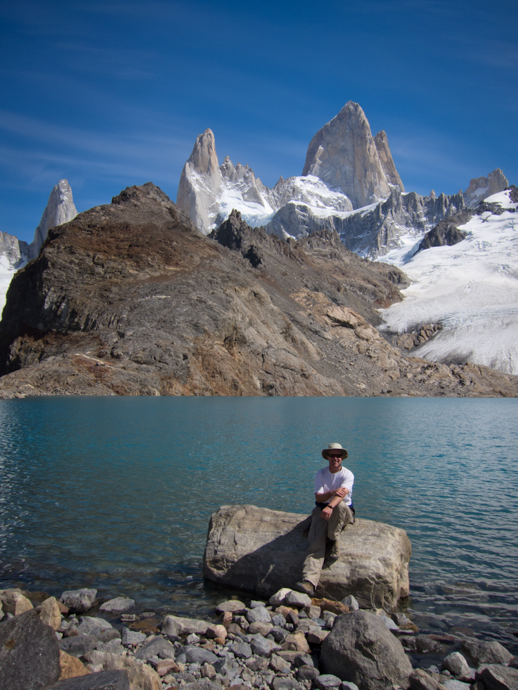
We have just returned from our latest camping/trekking trip in Patagonia, which again was 5 days/4 nights in duration. Our starting point was El Chaltén, a small village located at the base of Cerro Torre and Cerro Fitz Roy, both popular for climbing as well as trekking and camping. El Chaltén is the youngest town in Argentina, built in 1985 to help secure the disputed border with Chile. Today the sole reason for its existence is tourism. It is 220 km north of El Calafate.

We arrived in El Chaltén around noon last Friday and immediately headed out into the mountains to our first camp site, only a couple of hours away at the base of Cerro Fitz Roy where we set up camp and stayed for 2 nights.  We spent the next 2 nights in a camp ground at the base of Cerro Torre.  Spending a couple of nights at each site allowed us the opportunity to do day hikes without our packs, making the trekking much more enjoyable.
The trails in this area were much easier than those at Torres del Paine (perhaps with the exception of the trail to the lookout at Fitz Roy which was pretty tough going) and are very popular as they can be done as day hikes directly from El Chaltén.  So during the day, the trails got a little busy, but early morning and evening we had them virtually to ourselves.  Even so, the number of tourists was far less than those encountered in Torres del Paine.  The camp grounds were pretty sparsely populated with about a dozen or so tents set up each night.

The weather throughout the five days was absolutely perfect for trekking.  With the exception of one day when it was cloudy, we enjoyed clear, sunny skies, comfortable daytime temperatures around 15C along with no wind and no rain. The nights got a little cool, around 5C, except for the last night when there was frost on the ground. And the early mornings were downright chilly, giving us good reason to sleep in each morning.

Typical weather enjoyed each day.

Cerro Torre obscured by clouds on our only cloudy day.

The weather cleared the next day, giving us great 
visibility to Cerro Torre.

While conditions were absolutely perfect for this trek, we took roughing it to a new level, at least for us. Our camping gear was similar to our previous trek in Torres del Paine which included:

  • 1 three-man tent that provided barely enough space for each of us and our packs (I have no idea how three people, especially men, would actually fit into the tent);
  • 2 foam sleeping mats that provided some insulation from the cold ground but absolutely no comfort value;
  • 1 inflatable sleeping mat that we shared – well, actually, Chris used it for the first three nights since he was still complaining about his sore ribs (wasn’t that nice of me) but then damn his ribs, my bruised hips couldn’t take another night on the hard ground so I got the mat on the last night;
  • kitchen gear consisting of one pot, one metal spoon that we borrowed from our hostel (and returned I might add), 2 metal cups, 2 bowls and 2 “sporks” (combination spoon, fork and knife); and,
  • 1 ultra light burner with 2 cannisters of fuel.
We didn’t bring any heavy camera equipment (shocking, I know, but Chris decided the point and shoot camera would be sufficient this time around) and we kept our personal belongings and clothes to the absolute minimum.  Of course, Chris regretted not having his camera with him, and I regretted not bringing my binoculars.  Oh, and a deck of UNO would have helped pass the time away but without our steerage companions from Antarctica around to remind us of the rules, maybe it was just as well not to have the cards.  We had lots of time on our hands, so besides hiking and bird watching, we spent a lot of time talking and reflecting on the past six months and what’s coming ahead.  When we got really desperate to amuse ourselves, we played Rock, Paper, Scissors and a few rounds of hang man in the dirt.  I bet you didn’t know that limiting your words to just 4 characters makes it a rather challenging game?
All our gear and food for 5 days of camping
fit into our packs with lots of room to spare.
There were absolutely no services in this park.  Zero.  Well, unless you count the disgusting (and therefore unusable) outhouse which was basically a shelter around a pit in the ground, conveniently located in each camp ground.  No refugios, no kitchen shelters to protect against the elements. No running water, no sinks,  no toilets.   Nothing. Just us and the great outdoors.  Did I mention how grateful we were that we had perfect weather?  We washed our dishes in the mountain streams using sand to scrub them clean – something I remember doing on canoe trips with my dad when I was a kid. We washed ourselves in the same icy cold streams, careful not to rinse any soap into the clear, glacial waters as these were the same streams we were drinking from.
The first campsite – not too crowded here!
Eating in the “dining room”.
Each night we put all our food in a sack and
hung it from a tree.  The absence of wildlife in the
park was noteworthy, although we had been warned
that mice ran rampant and were a camper’s worse nightmare
as they would chew through anything if they detected food. 
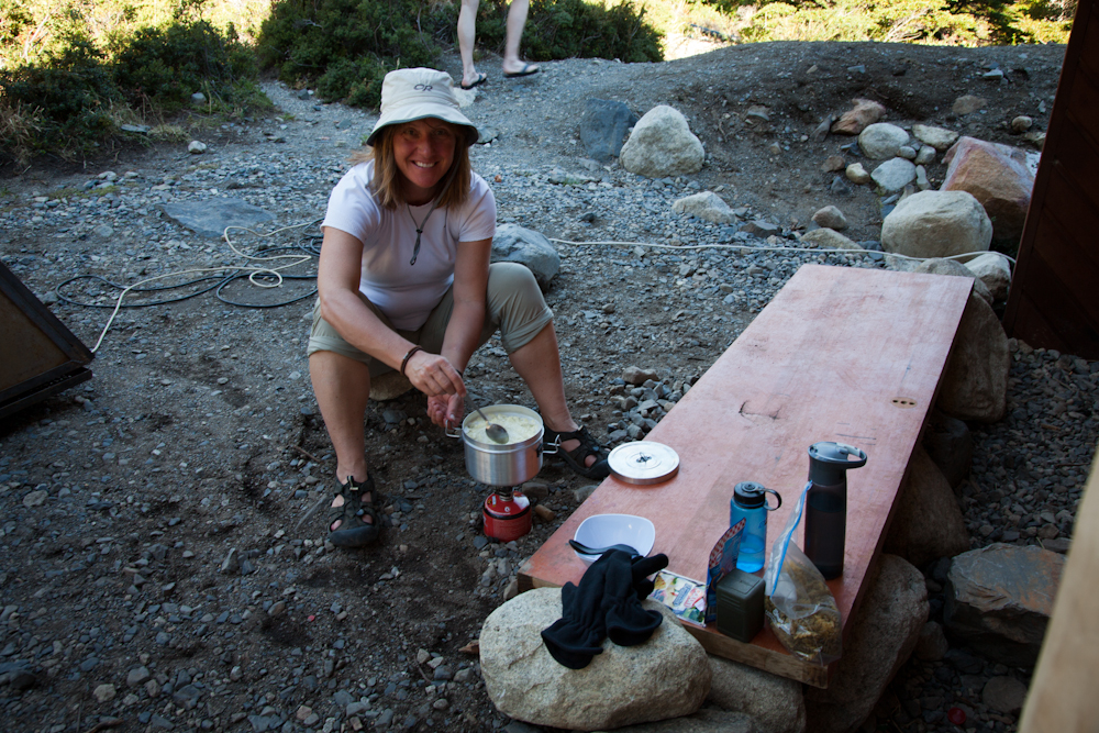
The chef at work:  food was basic, after all we only had one pot and spoon.
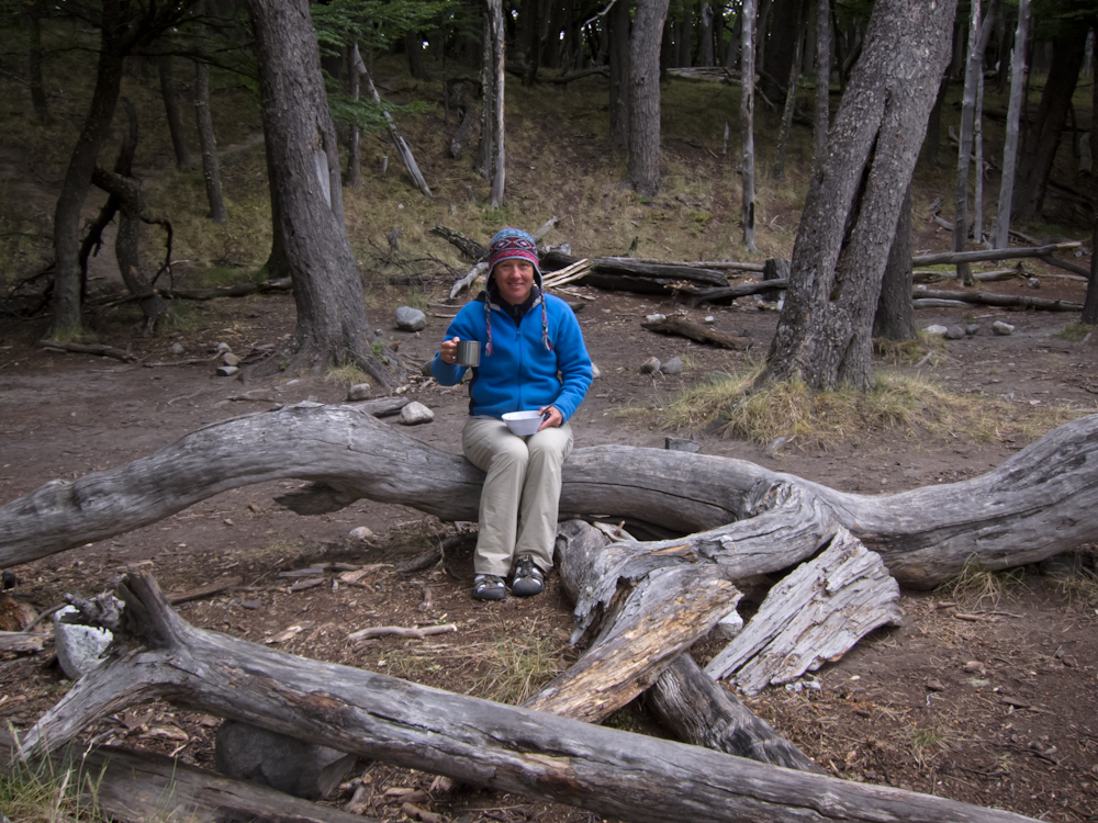
Enjoying a hot drink to keep warm.
Dead logs on rocks made a great table.
And so we camped and trekked for 5 glorious days enjoying spectacular scenery, basking in the warmth of the sun, restoring ourselves amidst the serenity and beauty of our surroundings.  It was one of the best camping trips we’ve had, and definitely the roughest camping yet.  Would we do it again? Definitely!
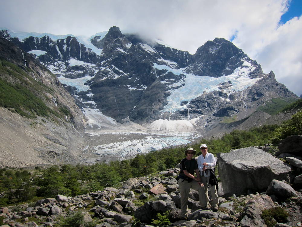
Climbing over boulders to get a better view of a glacier.
The view on the other side of the boulders.
The trails took us through forests such as this one as well
as through marshes and meadows (below)
and up and down rocky hills 
and mountains. 
Of the many birds we saw, this tiny Austral Pygmy Owl
(at least that’s what I think it is) was the most unusual.
We arrived back in El Chaltén on Tuesday morning at 11:00 am with two hours to spare before our bus returned us to El Calafate.  After making a few enquiries at some of the trekking shops in town, we successfully sold all our camping gear (excluding the ultra light burner) for about $80 US.  Considering we paid $110 US for the gear and camped for a total of 8 nights, I think we did quite well.

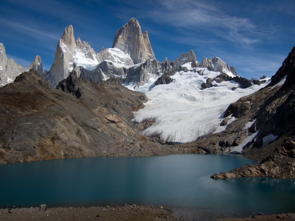
View of Cerro Fitz Roy from the lookout.  Well worth
the difficult one hour climb to the top. 

View of Cerro Torre as we were leaving on the last day, just before
the camera’s battery died.  How’s that for timing! 

Torres del Paine in all its glory and ferocity

Our hopes for hiking the “O” circuit in Torres del Paine were immediately dashed upon arrival at the park entrance when a park ranger informed us that the north west trail near the infamous Gordon Pass was covered in knee-deep snow and another blizzard was heading that way in just three days – exactly the time we would be reaching that part of the trail.  Reluctantly we adjusted our plans and decided to hike the “W” trail instead which was easily done in six days.  We had sufficient supplies for eight days of trekking, so we could take our time and enjoy ourselves.  In the end, we covered a little more than half the “W” in 5 days/4 nights.

Map of the trail:  Red line represents the “W”.
The circuit, also known as the “O”, includes the red and grey lines.

We arrived in the park around noon and set out shortly thereafter towards Campemento Torres which was only 1.5 hours away according to our map; this was the right arm of the “W” in the map above.  Our spirits were high in spite of our heavy packs but as the trail to Camp Torres steepened, my body resisted heartily.  My hips screamed in pain as we climbed the difficult trail.  Chris grumbled behind me – this was going to be a long eight days.  At least the weather was great – sunny with some clouds, a little bit of wind, and good hiking temperatures, around 18C.  Three hours later we arrived at the free camp, a lovely spot nestled in the trees about a 30 minute trek from the infamous “Towers”.  We quickly learned the estimated times on our map did not correspond with our hiking pace, not even close.

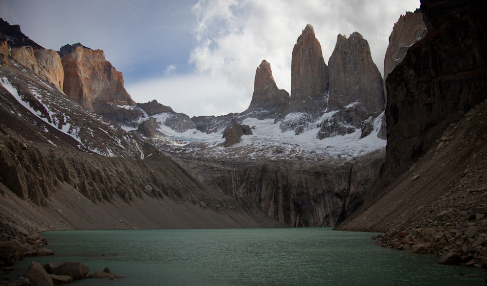
After setting up our little tent, and having lunch, we decided to trek up to the “Towers” while the weather was good.  The steep climb, probably the hardest on the entire trail, was a lot easier without our packs on our backs.  We were rewarded at the top with good visibility and a clear view of the “Towers”.   The wind had picked up when we were at the top and I was happy to have brought my bright yellow Quark expedition shell from our Antarctica cruise.  I nestled in amongst some boulders for protection and enjoyed the scenery for a while.

The “Towers” in Torres del Paine

That night, the wind howled through the trees above us, but we were well protected in the forest and our tent held up well.  It must have dipped to a few degrees above zero during the night, and I was cold in my sleeping bag in the early morning hours.  My parka doubled up as blanket over my lower extremities with my feet tucked into the hood, and my fleece kept my upper torso toasty.

We had a long day of trekking ahead of us on Day 2: 1.5 hrs back down the way we had come, and then 4 hrs west to the next camp, at Refugio Cuernos.  The winds were stronger as we began our trek down the mountain side, causing us to stop more than once to let the winds abate rather than risk being blown off the moutain side.

As we veered west, the terrain changed to an easier, hilly path that was quite enjoyable.  Our muscles were still resisting and our packs still felt heavy but I was comforted with the knowledge that our packs would lighten as we consumed food each day; we just had to resist the urge to hasten the process by eating more than the rations allotted for the day.

Along the trail we played “cat and mouse” with a few other younger couples who were heading in the same direction.  A camaraderie formed amongst us so that by the time we reached our first daunting river crossing, we worked together to figure out the best way to cross it. I’m not talking small streams that you cross in a couple of steps.  These were at least 20 feet across, with fast moving water rushing down with no clear way to navigate across.  For one such river, Chris and I changed into our hiking sandals, rolled our pants past our knees, and carefully walked through the frigid, ankle-deep glacier water.  We did quite well until the last river crossing.  After watching several people, Chris included, cautiously walk across large rocks, I followed suit.  At the last rock, a combination of legs that were too short and a strong, untimely gust of wind threw me off balance so that I missed the rock ahead and fell forward face first.  Luckily, I had my walking poles to brace my fall, leaning most of my weight into my left pole and angling my body so that I landed on my stomach on the large rock ahead, with both the camera bag which dangled from my hip and my back pack safely out of the water.  The only wounds incurred were my pride and my left walking pole that snapped in two under the force of the fall.  I counted myself lucky as it could have been a much worse outcome.

I was in good spirits all day, in spite of the heavy pack and the river fall.  The scenery was beautiful in every direction, the trail was manageable, and the weather was beautiful – sunny, around 18C, still windy but not like the early morning gusts on the mountain side.  But when we reached a sign that indicated we were only half way to the camp when I thought we were almost there, I hit a low, feeling like it was never going to end.  And then it got worse, much worse.

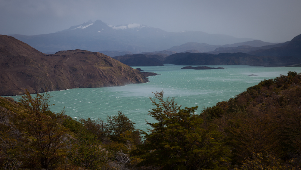
Out of nowhere, the winds picked up.  Before we knew it, we were dealing with gale force gusts of wind that literally knocked you off your feet.  And these gusts were unpredictable, coming at you suddenly, from any direction.  At this point, the trail hugged the side of a mountain, with a steep drop off  to the lake hundreds of feet below.  We started to recognize when a gust was coming – we could see the wind whipping up the waves in the lake below, next we heard the howl and then the wind would hit with a vengeance, soaking us with the mist from the lake.  We were exposed on this part of the trail and there was no where to seek shelter so we would all crouch low on the trail, sometimes on our stomachs and grab anything within our reach, tree roots or strong branches, hanging on literally for dear life so as not to be blown off the trail.  One guy ahead of us, was lifted off his feet and blown ten feet off the trail, luckily into some bushes and not down the side of a cliff.  Chris got thrown roughly against some rocks, bruising his arm, leg and a couple of ribs.  His camera got pretty banged up too.  It was frightening and slow going as we struggled against this wind for about three hours.  This was our first taste of the notorious Patagonia winds.

We arrived at Refugio Cuernos at around 4:30 pm, completely exhausted.  Luckily we found one of the last camp sites and somehow managed to set up our tent under these ferocious winds.  Tents were snapping in two, and blowing away all around us.  We weighted our tent down with six large boulders – as heavy as we could carry – inside the tent.  We piled boulders all round the tent pegs on the outside. We then huddled inside our tent wondering what the night would bring.  We were grateful for the military dinners provided to us by our B&B hosts, a  surprisingly tasty beef stew.  It was like magic watching the pouches heat up in a special plastic bag to which we had added a few tablespoons of cold water.  We would have gone hungry that night if we didn’t have these emergency provisions.  Our tent swooshed and swooned as the wind howled and swirled around us but it stayed in one piece and kept us dry even though it rained hard all night.

Others were not so lucky.  At around midnight, as we made our way to the bathroom, we were shocked to find about 30 people huddled next to the Refugio exposed to the elements; either their tents had collapsed, blown away, or there were simply no more sites available upon which to pitch a tent.  We were angered that the Refugio refused to allow this overflow into the building – there was plenty of space to make temporary beds on the dining room floor yet these unfortunate souls were locked out and had no option but to endure the night outdoors.

Since the next open camp site was more than 8 hours away, we decided to stay at Refugio Cuernos for two nights so that we could spend a day hiking into the French Valley (the middle arm of the “W”), reputed to be one of the prettiest spots in the park.  Amazingly, Day 3 was completely still, the lake as flat as a pancake, not even a ripple on the lake that had deluged us just the day before.  And it was stinking hot and humid. What crazy Patagonian weather. It took us over 2 hours to get to the French Valley even without our packs, and then we headed up the valley, but we didn’t get too far; I think we were still quite fatigued from the previous day.  During this hike, we learned that Campemento Italiano, at the base of the French Valley, was now open so that would be our destination on Day 4 – an easy 2 hour hike retracing our steps back to the French Valley.

Heading into the French Valley.  The glacier behind us
was continuously calving, causing thunderous roars and sending
avalanches of snow down the mountain side.  

Refreshing, icy cold water was readily available from the mountain streams.
The water was crystal clear, no need to treat or filter. 

That water was cold!

Preparing a pasta dinner at Refugio Cuernos on Day 3.
We splurged for a bottle of wine that night too! 

Day 4 was another beautiful day, a little cooler, but still clear and sunny and a mild breeze, just enough to cool us off.  I was feeling great physically, my body was no longer resisting the trek, and I was feeling very energetic and strong.  My pack was much more manageable too, probably five pounds lighter by now. We made great time to Campemento Italiano (less than two hours) where we left our stuff (we weren’t allowed to set up until after 5:00 pm) and headed back up the French Valley, this time reaching the look out which offered gorgeous views.  The weather was once again changing and we could see rain clouds rolling in so we decided to make our way back to camp to set up before the rain hit. This was my favourite camp ground, nestled in the trees, alongside a raging river.

At the lookout in the French Valley.

Steep trail heading up the French Valley.

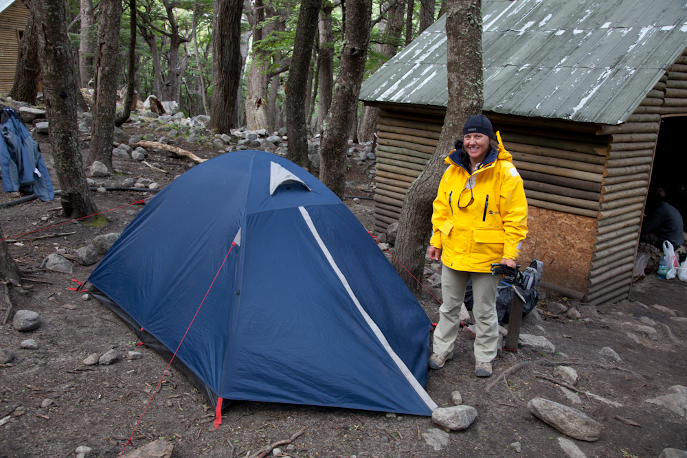
Campemento Italiano: My favourite campsite
(ours is the blue tent to the left).

It got really cold that night, probably close to zero.  We wore all our clothes including hat and mitts to keep ourselves warm.  It rained that night, but again our tent kept us dry.  Chris had a rough night, finding it difficult to breathe deeply with his bruised rib. 

There was a chill in the air the next day, our fifth day on the trail.  The plan was to trek 6 hours to Refugio Gray, or the camp ground 1 hour beyond if we had the energy.

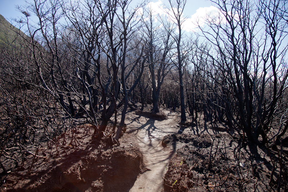
Refugio Pehoe in the distance surrounded by a charred landscape.

First we would pass Refugio Pehoe which was also the location to catch the catamaran out of the park. There was no camping allowed here as this area was completely destroyed from the recent fires. The fire came within a meter of the Refugio but the main building was miraculously spared.


It was surprising to see pockets of green vegetation
that had somehow been spared the ravages of the fire.

A distinct line where the fire stopped.

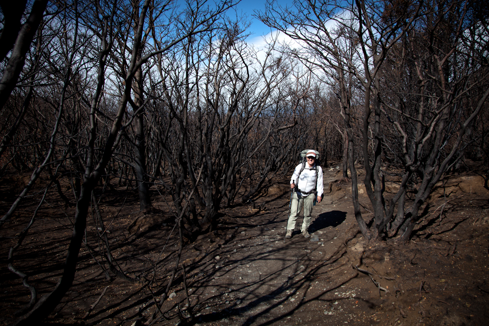
It was sobering as we entered the scorched forest, eerily still, nothing but charred skeletons of trees remaining.  The smell of burnt wood permeated the air.  It was really sad to see the devastation caused by careless human actions.

This was supposed to be an easy hike to Refugio Pehoe, but the wind was picking up again and it was biting cold.  As we reached the Refugio, walking into steady 50 km winds that were pelting us with dirt and charred debris, we saw the 12:30 catamaran heading into shore.

The thought of hiking 4-5 more hours into this biting wind through a scorched forest suddenly lost its appeal to both of us.  When I suggested perhaps we should call it a day and catch the catamaran, Chris agreed wholeheartedly, and I think he was secretly relieved that I didn’t want to push on.  And so concluded our 5 day, 4 night trek through Torres del Paine.

Although we didn’t stay in the park as long as we intended, I was proud of what we accomplished especially considering this was our first trekking experience.  We learned a lot for next time – the importance of keeping our packs as light as possible (forget the binoculars and the video camera), what food works best (we loved the cured salami that we snacked on for the first 2 days),  and generally what we’re capable of (we are old and we are slow).   This park lived up to its reputation for gorgeous scenery, but I was a little put off by how busy the trail was and how congested the camp grounds were at night.  There seemed to be a lot of confusion and mis-information within the park as to what was open, etc. but that may have been a by-product of the forest fires and not truly reflective of how the park is normally run.  I think we’re spoiled in Canada with all the wide open spaces we can enjoy and the beautiful, well run national and provincial parks at our disposal.

We’ve been back in our cozy B&B for a few days, resting up, having our laundry done and getting ourselves organized for our next trekking adventure to Fitz Roy Mountain (Cerro Fitz Roy), located in Parque National Los Glaciares (on the Argentine side of Patagonia). We’re travelling back to El Calafate today where we’ll spend the night and then head out to El Chalten tomorrow where we will begin our next trek. So we’ll be offline again for about a week.  Next stop is Buenos Aires where we will stay in an apartment for two weeks. We’re looking forward to returning to the warmth and sunshine (it was 25C in BA today).

Video:  Newbies Trekking in Torres del Paine
 

Antarctica Cruise Part 3: Reaching the Peninsula

After South Georgia, a full day at sea gave us all some much needed down time to relax, recharge and for many, to sort through the thousands of pictures taken thus far.  As the trip progressed I was polling some of the more avid photographers to see how many photos they were taking.  Chris was looking mighty good with his measly couple of thousand photos as compared to some who were close to 20,000!

I succumbed to the cold I had been fighting for a few days and welcomed the opportunity to rest.  Some were suffering from the effects of the increasing swells on the open water but we were assured these were still considered calm waters; it usually was much worse.  Others took the opportunity to stand on the lookout for whales which were noticeably absent thus far.  We did catch a glimpse of a few humpback whales off in the distance, and a pod of about ten orcas which was pretty cool.

During this part of the voyage, we travelled to the South Orkney Islands, Elephant Island, the tip of the Antarctica Peninsula, and the Shetland Islands.

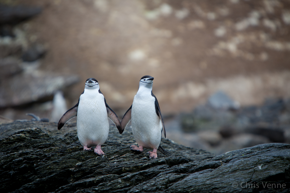
Chinstraps holding hands. Chris' favourite shot of the trip!

We interrupted our second day at sea with an excursion to Sandefjord Bay which lies between the west end of Coronation Island and Monroe Island, which are part of the South Orkney Islands.  We were still more than 600 km from the northeast tip of the Antarctic Peninsula so our journey was far from over.

The South Orkney Islands is a group of four main islands in the Southern Ocean of which Coronation Island is the largest measuring 48 km long.  The total area of the archipelago is about 620 square km of which about 90 percent is glaciated.  It was, therefore, not surprising to see all the ice in the water presenting a rather challenging landing for our zodiac drivers.  We enjoyed some beautiful scenery and observed a large colony of chinstrap penguins. After touring the colony on land, we took to the seas and explored the bay via zodiac.

A tricky landing!

A Weddell seal.

Chinstrap penquin covered in pink poop!  

I think this is a Weddell seal.

The scenery at Sandefjord Bay.

Video:  Tricky zodiac landing in the ice.

By now, ice bergs of all shapes and sizes formed an intricate part of the changing landscape.  I marvelled at these naturally formed sculptures, veritable works of art.  Our next stop was Point Wild on the northern coast of Elephant Island.  This was a hostile site comprised of a long, narrow ridge of boulders under high, vertical rock cliffs and the likelihood of landing here was extremely low; this became our one and only failed excursion.  However, history buffs were satisfied to get a good look at this site from the ship.  As  I mentioned in Part 2, it was on this spit of land between the boulders and cliff face where Ernest Shackleton’s crew of twenty-two men set up camp under a life boat when their ship Endurance sank in the Weddell Sea.  The stranded party was led by Frank Wild (Shackleton’s right hand man), for whom the site is named.  Shackleton and a few of his men made the infamous 800 mile voyage back to South Georgia to get help and returned to rescue his men with the vessel Yelcho four months later in August 30, 1916 – in the middle of winter.  A bronze bust of Yelcho’s Captain, Luis Pardo Villalon has been erected commemorating this historical event.  I’m afraid this historic site was lost on me that day as I was spending the day in bed recovering from my head cold.  I did manage to drag myself outside for a very brief glimpse of the rocky shoreline and the monument before returning to the refuge of my cabin.

Elephant Island

Paulet Island which is located in the Weddell Sea was an intriguing site to visit.  Not only did it hold historical significance, it was also home to 100,000 breeding pairs of Adelie penguins.  Sheathbills, skuas, and blue eyed shags also breed on this site. This was where Captain Carl Anton Larson and his 19 men and the ship’s cat were marooned during their 1901-1904 expedition after their ship, Antarctic, sank.  The remains of their stone hut are a testament to their resourcefulness and fortitude. This was another historic tale of courage, exceptional leadership and just plain good luck.  If you’re interested, click here to read a brief account of this story.

The remains of the hut built by Carl Larson and his crew on Paulet Island 

Today this remote island it is overrun by a large colony
of adelie penguins and their chicks.

As we approached Paulet Island in the zodiac, we observed a beehive of activity along the beach.  Thousands of adelie penguins were lining up along the shore, several feet thick.  As more penguins crowded onto the narrow beach, we held our breath in anticipation.   Suddenly, a collective cry arose from the swelling crowd.  And then one penguin dove in; that was all it took to trigger a wave behind him as a couple of dozen or so penguins quickly followed suit.  But then they stopped.  We were expecting the entire beach to plunge into the waters but that didn’t happen.  Once a small group had gone to sea, that was it; the remaining penguins reorganized themselves to fill in the gaps and to allow more room for the new arrivals.  Then they would start to cry out again and the whole process would repeat itself.  There was a continuous stream of activity as penguins marched to the shoreline, gathered in expectation, began their squawking and then dove into the sea in small increments.  Now and then a predator seal swam close along the shoreline on the lookout for a tasty snack.  The penguins would immediately sense the danger and react in unison retreating several feet away from the shore as if pulled by a string.  They would cautiously return to the shoreline after a few moments, but seemed hesitant to dive in.  We could have stayed all day watching these entertaining penguins.

Video: One, two, three…..GO!
 

Penguins collect pebbles to build their nests.  As you walk around the colony, you can see evidence of these nests everywhere.  But what was really amusing was the way in which penguins shamelessly steal pebbles from each other to build their nests.  Its not as if there aren’t enough pebbles to go around. More than once, we saw one penguin busily collecting pebbles for his nest and as soon as his back was turned to get a new pebble, another penguin would steal a pebble from his nest and take it a few feet away to another nest.

Video:  Adelie penguins building a nest on the remains of the stone hut built by Captain Larson and his men.  Watch closely to see if you can detect the thieving penguin.


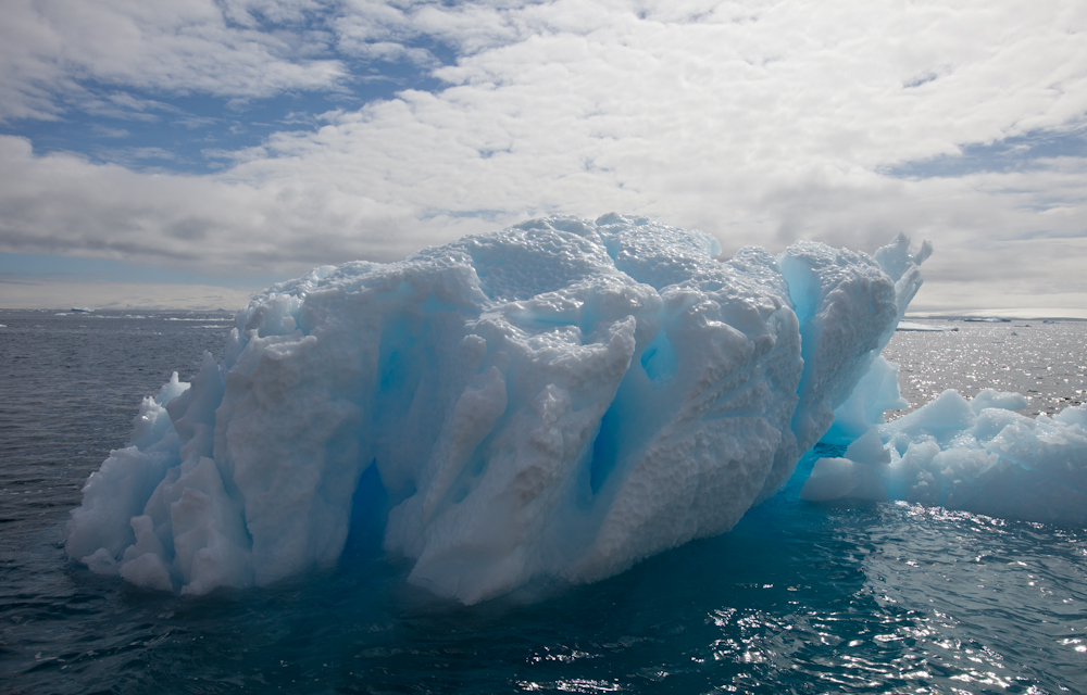
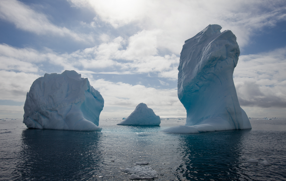
Icebergs were an integral part of the landscape now and I was simply mesmerized by their beauty.  We spent some time cruising in the zodiacs in the area known as “iceberg alley”.  I was envious of the kayakers who had the opportunity to paddle amongst these magnificent sculptures.

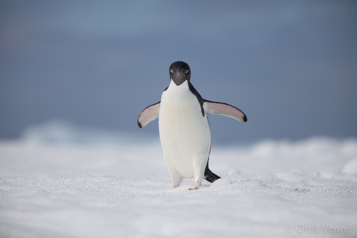
Adelie penguin on the ice.

The lovely pink hue of this ice berg is caused by penguin poop.

Survival of the fittest: this bird snatched a young adelie chick
and devoured it right before our eyes.

Later that same day, we landed on Devil Island which lies in a small bay southeast of Vega Island in the Weddell Sea.  This island is long and narrow with two peaks which appear as horns, offering exceptional views on a clear day.  As luck would have it, we arrived on a sunny, warm day – perfect conditions for the challenging hike to the peak.  At the top, we were richly rewarded with views of Cape Well-Met on neighbouring Vega Island.  I found a quiet spot on the mountain ridge and soaked up the view for as long as I could, long after everybody else had descended.  This was one of those tranquil moments on this trip where I could enjoy some rare solitude and simply absorb the serenity and beauty surrounding me.

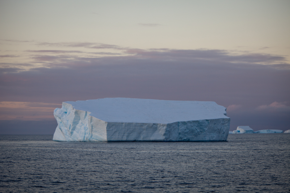
On the way to Devil Island, the shelf iceberg in the
background was the largest iceberg we saw,
easily measuring three times the length of our ship. 

Video: Heading straight for the biggest iceberg – shouldn’t we be turning??
 

Enjoying the solitude and the view from the top of Devil Island.

View from top of Devil Island.

Christina with Tricia amongst the penguins on Devil Island. Tricia was one
of my favourite people on board.  She was a feisty 72-year old
woman, travelling on her own, and she participated in everything
(including the polar plunge!)  with a fierce independence that inspired me.
She has travelled the world, about 110 countries at
last count, and she generously shared many travel tips.  

We were hanging out in the bar one night (did I mention we had an open bar for the entire duration of the trip?), when something caught our eye on the horizon in the fading light.  Whatever it was, it was swimming back and forth along side the ship with its huge head above water.  Turns out it was a southern right whale, skimming the surface using its baleen to sieve for krill.  It was such a strange sight to see and it really got the expedition guides excited as nobody had ever seen this behaviour before.

Video:  Southern right whale feeding
 

Finally – we landed on the coldest, driest and windiest continent – Antarctica! Our landing on the Antarctic Peninsula seemed somewhat anticlimactic after all the wondrous sights of the past two weeks.  We landed on Brown Bluff, an exposed section of a glacial volcano, which lies 14.5 km south of Hope Bay on the eastern side of the Tabarin Peninsula. We saw snow petrels and pintados nesting on the bluff face; adelie and gentoo penguin colonies littered the beach.  The chicks were inquisitive; if you were so inclined to sit on the beach, in no time one or more chicks would make their way over to check you out often snuggling right up to you as if you were their mother.

Landing on Brown Bluff – Antarctica!

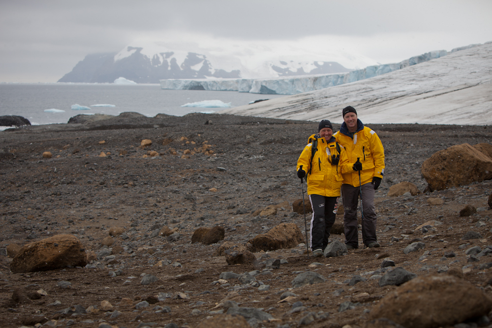
A fellow “steerage” passenger, Andrew, striking a pose on Antarctica.

A zodiac excursion in Kinnes Cove, a small bay indenting the western end of Joinville Island just south of Madder Cliffs offered fantastic up close views of beautiful ice bergs.  Sure, we saw lots of penguins and plenty of Leopard and Weddell seals sleeping on the ice bergs, but it was the ice bergs that simply took my breath away.  The variation in size, formation, color, and texture was astonishing.  Some were larger than our ship! These natural beauties reminded me of the stunning ice sculptures meticulously carved out byinternational  teams of artists during the Winterlude festival in Ottawa in February each year.

Our final day of excursions brought us to Whaler’s Bay on Deception Island and Hannah Point on Livingston Island, both of which are part of the Shetland Islands.  Whaler’s Bay is actually located in the caldera of an active volcano.  Instructions were given should an eruption occur:  get back on the ship and leave immediately (really?   I would never have thought to do that!)  As its names suggests, this bay was once home to a thriving whaling station at the turn of the century, the remains of which are rusting away on the beach today.  While many walked around these old relics for the morning, I joined a small energetic group who hiked to the top of a ridge from which you could see Livingston Island on one side and the Antarctic Peninsula on the other.  We again enjoyed perfect weather conditions and great visibility.

View heading down towards Whaler’s Bay (left).

We could see the Antarctic Peninsula in the distance (behind me)
from this lookout.

Remains of the whaling station.

Buildings deteriorating over time.

View of the whaling station from the ship.

Hannah Point was teeming with wildlife: Chinstrap penguins (about 1,500 breeding pairs), gentoo penguins (about 1,000 breeding pairs), a couple of macaroni penguins, a variety of other birds (blue-eyed shags, snowy sheathbills, kelp gulls, pintados, skuas and southern giant petrols), and elephant seals.  We were captivated by the sight of a small Gentoo chick that had inadvertently walked on top of an elephant seal.  Interestingly, when at sea, elephant seals are predators to penguins but on land they all get along just fine.  Still, it was a little disturbing to watch this fluffy chick in such a precarious situation.  After quite some time, the chick walked along the seal’s body, onto its head and then hopped onto the sandy beach.  He somehow managed not to get swept away at sea and returned to the safety of higher ground.
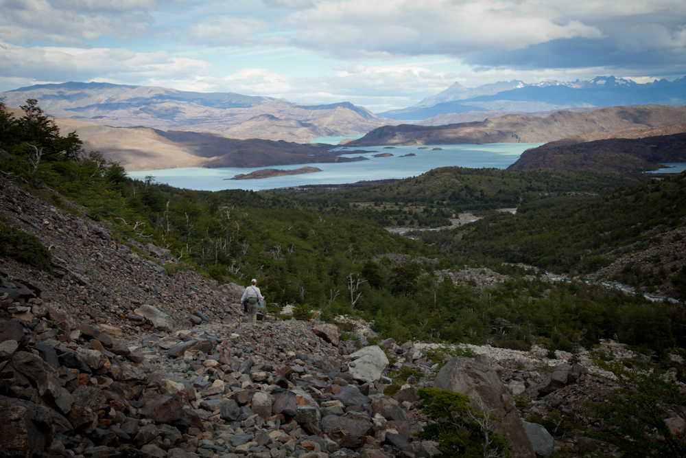
 Elephant seals lounging around on the beach.

Hey, you don’t look like my mother!

Our final two days at sea were spent travelling through the notorious Drake Passage.  The seas did swell during this crossing, but it was tame compared to stories told by the crew.  Chris and I along with three other passengers from the “steerage” deck (our nickname for Deck 2 where our cabins were located), received invitations to sit at the Captain’s table for the final dinner.  I am still perplexed as to how and why the steerage gang received invitations, but we all accepted the honour and thoroughly enjoyed the experience.

Dinner at the Captain’s table on the last night at sea. 

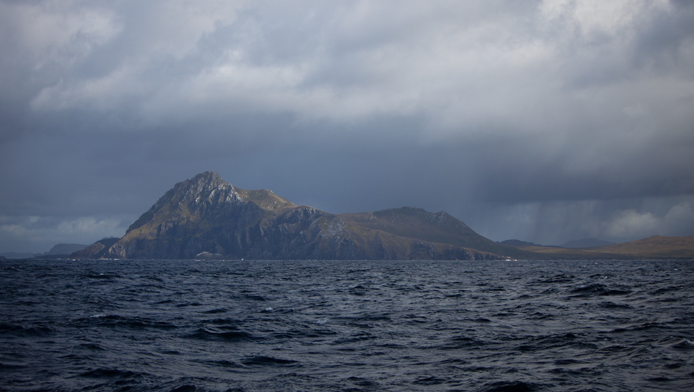
The final morning of our passage through the notorious Drake Passage brought us in sight of Cape Horn, the southernmost tip of South America.  Our captain had navigated the ship somewhat off course to avoid several storms thus taking us into the Pacific Ocean off the south west coast of Chile.  We then turned east and headed towards the Beagle Channel.  The Drake Passage is dreaded by most travellers as it has a reputation for severe weather and corresponding seas.  For the most part, the seas were relatively calm during our voyage through the Drake.  Aside from some swells during one night, and some small pockets of precipitation when we neared Cape Horn , it was clear sailing all the way back to Ushuaia!

Cape Horn,  the southern most point in Chile, South America

Patagonia here we come

At the end of our Antarctica cruise last Wednesday, we flew to El Calafate because this was the fastest, most direct way to get to Puerto Natales which is where we would get ourselves organized for our big trek in Torres del Paine.  We were pretty tired after our cruise and needed a few days to just chill and get caught up on our blog.

We spent four nights at Hosteria Patagonia which was the most inhospitable accommodations we have endured thus far.  The establishment was quite new and the rooms were spacious and comfortable enough, and the place was absolutely spotless (just trying to be fair). The problem was in the way they ran the place – more like a prison camp than a hostel – rules for everything, such as forbidden to open the fridge without authorization.  I was chastised repeatedly (in Spanish of course) for all my transgressions – going into the kitchen to clean my dirty dishes (I know, the nerve of me), for putting a sweater on a railing to dry, for using the microwave without permission, etc. etc.  Ah well, the town was booked solid, so moving wasn’t an option.  We sucked it up, what else can you do?

Hosteria Patagonia looked good on the outside,
and even the inside too; too bad it was so unwelcoming.
Notice the two beautiful lavender bushes in front of me –
lavender grows prolifically here in this inhospitable climate. 

During the four days we spent in El Calafate we did a couple of interesting activities, namely, a “mini trekking” tour to Perito Moreno Glacier and a visit to the recently opened Glaciarium, a museum about glaciers.  We just couldn’t resist visiting the world’s largest reserve of fresh water!

The mini-trekking tour included transportation to Perito Moreno Glacier which is located in Los Glaciares National Park. We learned that this was one of a very few number of glaciers in the world that maintained its size over the years – it extends and contracts but remains a fairly constant size. The terminus of the Perito Moreno Glacier is 5 kilometres (3 mi) wide, with an average height of 74 m (240 ft) above the surface of the water of Lake Argentino. It has a total ice depth of 170 metres (558 ft).  This glacier is renowned for the rupture that occurs every few years.  It is due for another rupture at any time.  Click here if you’re curious about what the rupture is all about.

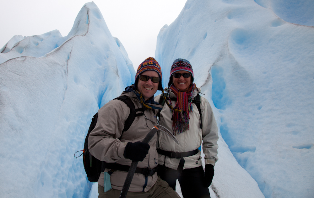
In the morning we walked along the walkways to observe the north end of the glacier. Every now and then we would hear an explosion as the glacier calved and huge chunks of ice cascaded to the lake below.  In the afternoon, we took a boat ride along the south face and then, after lunch, hiked with crampons for a couple of hours on the glacier itself. We continued to hear the glacier and see it calve several more times.  It was an amazing experience.

(Coming Soon) Video:  Walking on a glacier with crampons.

The Glaciarium Museum was very modern and the exhibits were well presented.  Since all exhibits and videos were offered in both Spanish and English, we learned a lot more about glaciers during the couple of hours we spent there. Located in an open field a few kilometres outside of town, the building rattled and shook under the force of the Patagonian wind – I thought the whole thing was sure to collapse at any moment.

We arrived in Puerto Natales on Sunday afternoon by bus, passing through the Argentina/Chile border once again without any problems.  We lucked in on our accommodations this time; a lovely B&B called Pire Mapu Cottage.  It is a little two bedroom guest house with two bathrooms, common kitchen and living area.  The owner, Brendon (an ex-Brit) and his wife, Fabiana (who is Chilean), have completely and lovingly renovated this house and just opened it up for business this season.  It is a charming home, with so much attention to detail that you feel like you’re visiting a friend’s cottage.  They have thought of everything to make their guests feel comfortable and at home, such as a well equipped kitchen, flat screen tv’s (with english stations) hanging on the walls of each bedroom, the fluffiest towels in South America, home baked cookies and tea to greet you. I could go on and on.  As soon as we stepped into the house, we booked a third night on the spot.  And we were tempted to stay even longer.

The service they offer is impeccable.  They picked us up at the bus station and bent over backwards making sure all our needs were taken care of throughout our three night stay.  For example, when Chris asked where he could find a barber in town, they insisted on driving us to the hair salon and Fabiana served as translator to explain the new hairdo Chris wanted.  I think he looks awfully cute in his new “do”.

Our cottage mates on the first night were a couple of ladies from the US (Deb and Lisa) who were heading out early in the morning to go trekking in Torres del Paine for two nights.  We really hit it off with them and decided to collaborate on dinner that night.  Well, actually they did all the grocery shopping and pretty much most of the cooking; Chris did the clean up.  I didn’t do a heck of a lot, but nobody seemed to mind.  We had a wonderful meal – those girls know how to cook – and great conversation over three bottles of Chilean wine.  We talked into the wee hours of the morning.  They were so relaxed about their trek; this was their fourth week of trekking in various parts of Patagonia so I guess they were pretty organized (unlike us).

Breaking bread (and drinking wine) with new friends.

The next night we had the cottage to ourselves, with the owners popping in now and then to check if we needed anything.  One more comment about the cottage – they served one of the best breakfasts we’ve enjoyed thus far in South America.  Home made bread, eggs, ham, cheese, juice, two types of brewed coffee, and toast.  It kept us going til late in the afternoon.

Typical breakfast at Pire Mapu with the
hosts at work in the kitchen behind me.

We have spent the last couple of days still working on the blog (I hate it when we get behind because it is so much work to get caught up) and getting ourselves organized for our big trek.  We have decided to do the “Circuit” which is an 8-day trek – on our own, no guide or group.  Not only did we not have any camping equipment with us, we have never done this kind of camping before.  We’ve camped a lot, but always car camping.  I have to admit, I’m a little nervous – especially with a very bad weather forecast for the next few days (blizzards and very high winds – yikes!).  I’m most perplexed about the food we need to bring.  With regards to the camping equipment, we had planned on renting it all here in town until we ran into a couple of Finnish lads who were selling all of their equipment on a street corner. They had bought it all two weeks earlier in Ushuaia and were now finished with their camping trip.  We bought the whole kit and caboodle – tent, sleeping bags and sleeping mats – for $100.  All we needed was the kitchen equipment. Now we’ll be able to do a couple of more hiking/camping trips in El Chalten and Bariloche before heading to Buenos Aires – that assumes, of course, we survive this one.

Busy blogging, and organizing the trek,
while enjoying home made beef stew.

This afternoon we heard the weather forecast for the next few days:  Bad.  Very bad.  And late this afternoon guess who showed up at the cottage?  Deb and Lisa returned one day early because the weather was so bad.  So who knows, we may be back sooner than we planned.

Optimistically, we’ll be off-line again for the next 8-9 days.  Wish us luck – I’m sure we’re going to need it!  Before I sign off, just a heads up that we’re almost finished Part 3 of the Antarctica post but I’m afraid we ran out of time and it will have to wait until we get back.  Chao!

Eight days of trekking food.
It was a challenge finding the right food for a trek here
so you just had to be creative when you don’t find things
like protein bars or healthy granola bars.  Chris loved
the improvisation with the snickers bars 🙂 


Antarctica Cruise: Part 2 – South Georgia Island

After two days at sea travelling through unbelievably calm waters with low winds, the Island of South Georgia came into view.  We spent a total of four days exploring this icy paradise, home to millions of sea and land birds, penguins, and seals. History came alive as we walked in the footsteps of explorers of the past.

We were blessed with consistently good weather during these four days allowing us to enjoy two daily excursions.  It is common for ships to be limited to only one or two excursions in total because of inclement weather such as high winds, large sea swells, or blizzards.  Kayaking in South Georgia is rare; yet our group enjoyed two kayaking excursions!  In case you were wondering, we did not kayak during this trip.

The kayaking group was limited to 16 people and all the spots were filled by the time we bought our tickets. There was one cancellation and Chris and I discussed whether or not one of us should go for it. Since we both wanted to do it, and we would both be very jealous if the other one did it, we decided for the sake of marital harmony we would both decline.

Before stepping foot onto South Georgia, all passengers were required to follow stringent biosecurity procedures designed to ensure we did not inadvertently transfer plant life from one location to the next.  We attended vacuum stations where our packs and outer clothing were scrutinized and vigorously cleaned.  Every time we left the boat, we walked through a disinfecting solution and every time we returned to the boat we were required to scrub out boots and lower pants as well as any equipment that may have touched the ground such as tripods or walking poles.

Here’s a brief summary of some of the memorable moments and highlights of the places we visited on South Georgia.

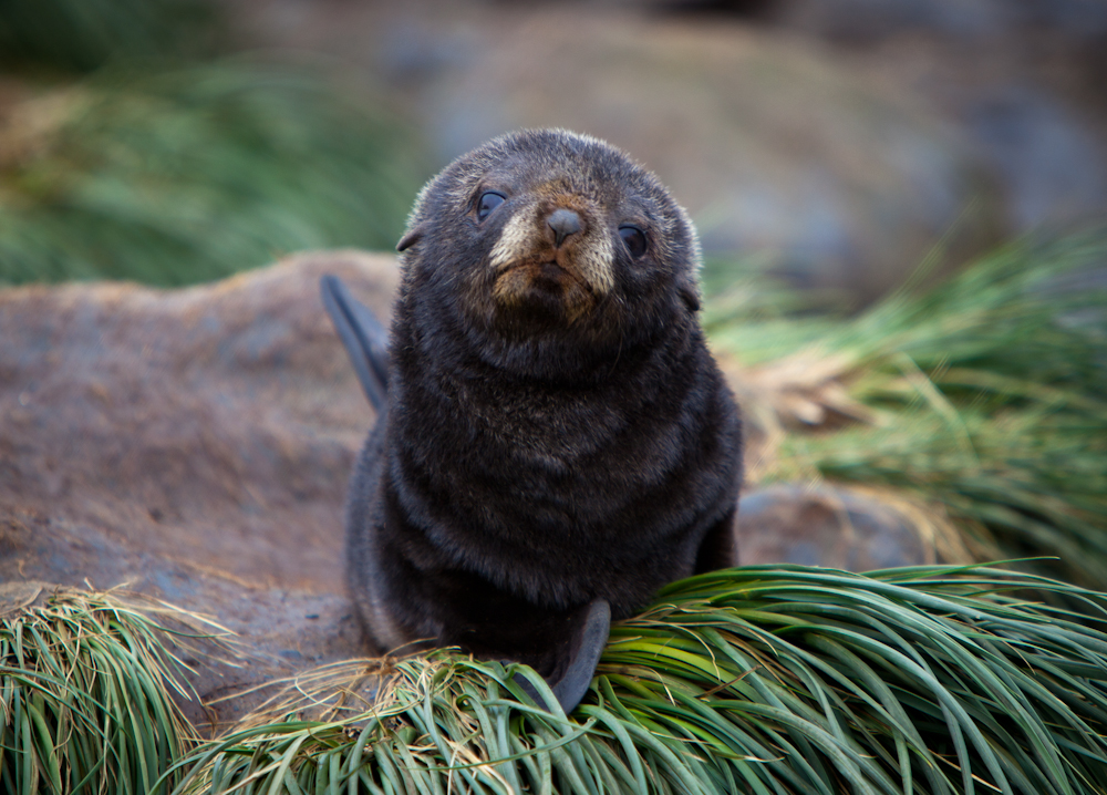
By zodiac, we cruised the calm waters in the Bay of Elsehul, on the northwestern extremity of South Georgia, and were rewarded with terrific views of three species of albatross birds (black-browed, grey-headed, and light-mantled sooty), three species of penguins (king, macaroni, and gentoo), as well as blue-eyed shags, several species of petrels (including giant, cape and lesser snow), prions, southern elephant seals and fur seals. The haunting wails and piercing cries of the medley of wildlife formed a symphony of sounds that will forever be in my memory.

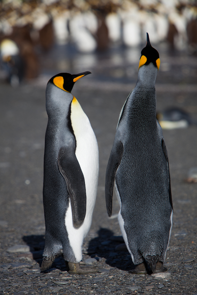
Our first sighting of king penguins – what a thrill!
And look at all those fur seals.

On the beach: elephant seals, fur seals, king, macaroni and gentoo penguins.

Video:  Nature’s symphony

Salisbury Plain, on the southern shore of the Bay of Isles, 50 km from the western tip of South Georgia is home to the second largest king penguin colony on the island with an estimated 60,000 breeding pairs that swells to about 250,000 individual penguins during the molt.  This location marked our second excursion and our first real introduction to king penguins, certainly on such a massive scale.  Immediately upon landing, there were king penguins as far as the eye could see.  In the distance the full colony stood in all its glory.

But first, we had to manoeuver our way through vast groups of fur seals who were not always happy to see us.  The pups were absolutely adorable, inquisitive, friendly and very playful, and entertained us to no end.  In contrast, the male fur seals were very territorial and could be vicious and quite aggressive; we were chased more than once if we happened to unwittingly venture into a male fur seal’s domain.

Video:  All the action on Salisbury Plain

The sight and sounds and yes, even the smell of so many king penguins in one location was thrilling and awe inspiring.  But nothing compared to the experience of sitting quietly on the ground and having a small group of penguins come up to check you out, often pecking at your boots or your pants.  These wondrous creatures exhibited no fear of humans, but seemed to be as curious about us as we were of them.

Video:  Chris bonding with the chicks.

Chicks marched about in search for their mother, squawking incessantly as if to say: I’m hungry, I’m hungry, I want my mommy now.   And the mothers (or fathers for that matter as both are responsible for the chick) once found (a seemingly miraculous feat in and of itself), seemed quite unaffected by their chick’s plaintiff cries, often walking around for some time, with their little chick trailing behind squawking at the top of their lungs.   She would feed her chick in due time, when she was ready and not a moment sooner.  We learned later that this behaviour served an important purpose; as the chick chased after its parent for food, it’s wings and legs were strengthened, preparing it for life at sea.

The colony was going through the molting period where they shed their feathers and replace them with new ones.  Molting occurs once each year, usually after the breeding season.  This is an essential function because feathers wear out during the year; they become worn out when penguins rub against each other, come in contact with the ground and water, and regularly preen (clean, rearrange, and oil) their feathers.  The new feather grows under the old one, pushing it out. The old feather does not fall out until the new one is completely in place. The molt is patchy and can give individual penguins a scruffy look.  During the molt, feathers lose some of their insulating and waterproofing capabilities, and penguins stay out of the water until their plumage is restored to optimum condition.  Because penguins don’t enter the water to feed during a molt, they fast. Before their molt, they build a fat layer, which provides energy until the molt is over.   The younger chicks looked cute and adorable cloaked in fluffy brown feathers like a fur coat, but the older chicks and juveniles looked downright ugly.  Lucky for us, the colony had swollen in size because of the molting period. 

Prion Island is a site of high environmental sensitivity and exceptional conservation value as it is one of a few rat-free tussac islands remaining along the rat-infested South Georgia coastline.  Rats were inadvertently introduced hundreds of years ago and surprisingly have thrived in this harsh climate.  They are a huge threat to bird populations.  South Georgia Heritage Trust is a non-profit organization involved in many projects on the island, including an ambitious rat eradication program, that if successful will result in a restoration of bird populations by 10-100% in coming years.

South Georgia Pipit

This was the site of our third excursion.  Following a slippery boardwalk through the tall tussac grass, mindful of the many fur seals in our path, we reached the breeding site of the wandering albatross and were delighted to see several beauties sitting on their nests close by.  One bird opened its expansive wings giving us the opportunity to admire the beautiful 3-4 m wing span up close.  These birds are huge and it is rare to see them in such close proximity.  We also saw our first endemic South Georgia pipit which looked much like a sparrow.  The pipit is the Antarctic’s only song bird, and South Georgia’s only passerine, and one of the few non-seabirds of the region.  While this bird didn’t really look all that special, it is threatened mainly because of the high rat population.  So it isn’t surprising that the South Georgia Heritage Trust chose this little bird as their poster bird in their campaign to eradicate rats.

The Wandering Albatross has the largest wingspan of any
living bird,  averaging from 2.51–3.50 m (8.2–11.5 ft),
with a mean span of 3.1 m (10 ft) in one colony.

Fur seals amidst the tusac grass bordering the boardwalk.

A young elephant seal on the beach.

Fur seal pup – isn’t he a cutie!

A zodiac cruise around Hercules Bay, located 2.5 km northwest of Cape Saunders, offered spectacular views of the towering cliffs that encircled this miniature fjord.  The kayakers had the opportunity to explore the bay at a more leisurely pace.  We saw plenty of macaroni penguins along the rocks that hugged the base of the cliffs and fur seals and elephant seals covered the beach.  But no reindeers were to be seen that afternoon.

Our visit to Stromness, an old whaling station, began at Fortuna Bay.  As we hiked 5.5 km to Stromness, we paused now and then to listen to Damien our historian, read passages describing the historical crossing by Sir Ernest Shackleton and his small team in 1915.

For those of you not familiar with this piece of history, this is basically what happened. Shackleton and his crew were on their way to Vahsel Bay where they were going to attempt the first ever land crossing of Antarctica,  an epic transcontinental voyage through the South Pole.  His ship, Endurance, became stuck in the ice and eventually sank by the crushing ice.  Shackleton and his men spent months in makeshift camps on the drifting ice, until they were able to reach the inhospitable, uninhabited Elephant Island by lifeboats (we visited this location later on).  Shackleton and five of his men travelled 800 miles to South Georgia in a small vessel (the replica was in the South Georgia Museum in Grytviken) where they landed at Fortuna Bay.  We sailed these same seas and I have no idea how Shackleton found South Georgia, let alone Fortuna Bay – it would have been like searching for the proverbial needle in a hay stack. Once they landed at Fortuna Bay, cold, tired, and starving, they then traversed the frozen land (it was winter) and found their way to Stromness.  From here they mounted a rescue party and went back to rescue the men waiting on Elephant Island without a single loss of life.

Rainbow over Fortuna Bay

As we made our way up to the mountain pass through which we would get to Stromness, a perfect rainbow arched over our ship in the bay. At the top, the fierce wind was was strong enough to knock you down.  Approaching Stromness, an old whaling station, we saw our first herd of reindeer, which had been introduced at the turn of the 20th century as game for hunting.  The reindeer are considered a nuisance and will also be eradicated as part of the rat eradication program described earlier.

Where’s Chris and Chris?

Christina (right) and fellow passenger, Gail, lagging behind
the group as we head for the mountain pass. 

Hiking the rather steep path down into Stromness.

The remains of Stromness whaling station are now home
to a myriad of wildlife: king penguins, fur seals,
elephant seals, and a large variety of birds. 

It was a warm day for the hike, so I wisely decided to
wear lighter clothing rather than the yellow, Quark-issued
parka, which, by the way, was ours to keep.

Grytviken is home today to a small research centre, a museum and it serves as the UK administrative centre for South Georgia and the South Sandwich Islands.  But ghostly remnants of the past are visible everywhere. This was the location of a large whaling station which operated from 1904 to 1966.  Today, all that remains are the rusted out remnants of the equipment and buildings as well as a few shipwrecks in the bay.  At its peak, the size of operations was surprisingly (at least to me) large; sadly, it was hugely successful, with 195 whales taken in the first season alone. The whaling industry of South Georgia grossly overexploited stocks and had cruel methods of killing. According to the South Georgia Heritage Trust, in the whole of the Antarctica region some 1,432,862 animals were taken between 1904 and 1978, when hunting of the larger species ceased. Probably the largest whale ever recorded was taken at South Georgia; it was a blue whale processed at Grytviken in about 1912, with a length of 33.58 meters.

South Georgia Museum in Grytviken

The South Georgia Museum at Grytviken offered a glimpse into the past with displays covering a variety of subject areas such as the discovery of the island, the sealing industry, maritime and natural history, as well as the 1982 Falklands War.

Dahlia (from Toronto) is standing below
a wandering albatross at the entrance of the museum.

Shackleton’s grave is found in the cemetery at Grytviken.  On November 27, 2011, the ashes of Frank Wild who was Shackleton’s “right hand man” were interred on the right hand side of Shackleton’s grave. We paid our respects and homage to these courageous explorers of the past with a toast at their graveside.

Shackleton’s grave

Engraved on the back of Shackleton’s grave,
is a quote by Robert Browning:
“I hold that a man strive to the uttermost
for his life’s set prize.” 

On our final day in South Georgia, we awoke to brilliant sunny skies and calm seas which made our trip to Gold Harbour all the more memorable.  We visited another colony of king penguins – about 25,000 breeding pairs in total, and a much smaller colony of Gentoo penguins – about 300 breeding pairs in total.  Elephant seals dominated the beach landscape.  These huge, blubbery animals were quite a sight to observe.  It took an enormous amount of energy for them to move their bodies a few feet before they would collapse in seeming exhaustion.  Similarly, they sparred vigorously and often violently with one another for a few minutes, only to suddenly collapse onto the sand unable to sustain their effort any longer.  It was actually quite comical to observe.

Fur seal tangled in a blue fishing net. Our guides tried to get the
net off the seal, but didn’t succeed; the little guy
kept running away frantically.

 Elephant seals on the beach with king penguins in the background.

Molting king penguins.

Molting king penguin up close.

Video:  Elephant seals sparring
 

Southern giant petrols patrolled the beaches in search of feeding opportunities. One such opportunity presented itself as a king penguin inadvertently exposed her egg allowing a quick thinking and quick moving petrol to swoop in and knock the egg away from its mother before proceeding to crack open the egg and eat the contents.

King penguin checking its egg.  

I found it interesting how we humans seem to be emotionally attached to the penguin and not sympathetic at all to the needs of the petrol.  He has to eat too, you know.

As the day progressed the weather deteriorated raising concerns that we might miss our final excursion planned at Cooper Bay, located at the southeast extremity of South Georgia.  Luckily we were able to visit this location, both on land and via zodiac cruise, affording us a rare close up view of a macaroni penguin colony, as well as the chinstrap penguin, so named because of a thin black line below its chin.  The kayakers were even able to get out for a second time to explore the rocky shoreline.  The color and formations of the rocky cliffs were outstandingly beautiful.


Macaroni penguin

Chinstrap penguin

We caught our first glimpse of ice bergs just before we left South Georgia as our ship entered the Drygalski Fjord which was shrouded in mist and low lying fog.  A sudden blizzard added to the mysterious landscape.  We lamented the poor visibility that prevented us from seeing majestic glaciers and ice capped mountains, shadows of which we could detect beyond the fog.  Just as we reached the end of the fjord, miraculously the fog lifted to reveal the true beauty of the fjord.  This was a taste of what was to come.

Drygalski Fjord

Antarctica Cruise: Part 1 – Falkland Islands

We were an unusual sight as we boarded the Sea Spirit with our packs on our backs, without a doubt the only backpackers amongst this well-heeled crowd.  We settled into our suite – yes, we had a beautiful suite that included a bedroom area with a king bed, dresser and two portholes, a living room area with couch, chair, television, and of course a private bathroom  – this was a luxurious amount of space compared to hostel living! A welcoming cocktail in the bar on the upper deck gave us our first opportunity to meet some of our fellow travellers.  It would take a while to meet each of the 100 or so passengers and even longer to remember everybody’s names but we had plenty of time, almost three weeks at sea.   We pushed off around 6:30 pm under sunny skies and with calm seas along the Beagle Channel, an omen of the weather to come.

Our first port of call was the Falkland Islands.  I knew little about these islands other than a faint recollection of the war that occurred in the early 80’s.  Luckily for me, it would take a day at sea to reach the Falklands and this time was spent listening to several lectures about the history, geology, and zoology of these fascinating islands.  Time was also spent doing the mandatory safety drill as well as a zodiac briefing.

Our first day at sea went something like this:  breakfast, lecture, snack, lecture, lunch, lecture, snack, cocktails at the open bar, zodiac briefing, dinner and more drinks.  By the end of the day, we were exhausted!  This would become our routine, more or less during the days at sea.

We spent two days on the Falkland Islands; one day visiting New Island and Carcass Island and the second day in Port Stanley.

New Island, located on the western side of the Falkland Islands, was our first stop.  A kilometre long stroll inland led us to a thriving rock hopper penguin rookery. The rock hopper penguin is easily recognizable by the long, wispy, yellow feathers above their eyes and the crew cut on the top of their head. It is smaller than the Magellanic penguin, and their habits seemed quite different; for instance, the Rock Hopper chicks congregated together away from the adults, rather than clinging to their parents as the Magellanic chicks did.  It was remarkable to observe the rock hopper penguins, cormorants, and black-browed Albatross and their chicks co-habiting in peaceful harmony.  Now and then a predator such as a blue eyed shag, would swoop down and threaten to snatch a young chick.  All were safe on our watch!  We spent three hours observing and photographing these fascinating subjects.

Observing the rock hopper colony on New Island.

Black browed albatross on nest with chick.

Lonely cormorant.

Cormorants on nest with chicks amidst the colony.

Rock hopper penguin with chicks.  Notice the little guy 
flaked out on the rock in the background. 

It was fascinating to watch the colonies of the different species:
the albatrosses 
with their huge wing spans flew in large circles
overhead while their fluffy grey chicks laid in their elevated 
nests on the cliffs;
the rock hopper chicks walked around looking for 

their parents; and the cormorants were busy building their nests.
We could have 
stayed all day, it was so interesting. 

At this point in the trip, Chris was suffering from lens envy in a big way.  Usually Chris is the king of the proverbial photographic castle, but here, his few lenses were dwarfed by some pretty serious equipment and equally serious and talented photographers.

Examples of some of the photography equipment
and serious photographers on board.

Carcass Island, located on the northern tip of the west side of the Falkland Islands was our second stop for the day.  This area reminded us of Isla Magdalena, Chile where we saw the large breeding colony of Magellanic Penguins, but this was on a much smaller scale.  Still, we observed the adult pairs with their pairs of chicks staying close to their nests in the ground.  We also saw a colony of gentoo penguins  – our first encounter with the gentoos.


Christina walking amongst the tall tusac grass towards the magellanic
penguin colony.  
You had to be careful as there were nests hidden in the grass
and it would be easy to step on one if not watching carefully. 

Two magellanic penguins close to their nest.

Gentoo penguin with colony in background.

Typical landscape of the island.

We passed a beach with sand as white and fine as refined flour, contrasting sharply against the aquamarine colored sea.  From here, we could see large groups of penguins swimming close to shore, purposing out of the water just like miniature dolphins and whales.  I plunked myself down on the sand and just watched.  A few gentoo penguins approached, as curious about me as I was about them.  I watched them and they watched me – it was magical.  I could have stayed there all afternoon, but we had a 3.5 km walk ahead of us and a schedule to keep.   

Tusac grass along the edge of the beach.  These grasses reminded me
of the ornamental grasses we plant in our gardens in Ottawa,
although these were on a much larger scale. 

Magellanic penguins on the beach.

Gentoo penguins on the beach.

Gentoo penguin in a hurry.

Heading out on our 3.5 km walk with 
promises of an English Tea waiting for us at the other end.

Video synopsis of our first day in the Falkland Islands.

Rob and Lorraine, the only inhabitants of the island, and who also run a B&B, provided a spectacular English Tea. I assume everything was made from scratch; it’s not like there was a local bakery they could call up.  Imagine preparing afternoon tea for 100+ guests.  You’d better make sure you don’t run out of sugar or anything else for that matter – no neighbours from which to borrow, and no grocery store around the corner either.  Rob and Lorraine have been the sole residents on this island for over 20 years!  Apparently, it is quite popular to fly directly to the Falkland Islands from London, and then island hop staying in isolated B&B’s along the way.  Not only did we enjoy a piping hot mug of tea, but we indulged in delicious, home made scones with fresh cream, tarts, and a variety of delicate cakes and squares.  I could not imagine living in such a remote location, let alone being the only inhabitants on the entire island!

We awoke the next day to find ourselves docked at Port Stanley, the capital of the Falkland Islands, with a population of about 1500.  We were given a few options of how to spend the day – walk to a place called Gypsy Cove or go to town to visit the museum and the shops.  It was a free day to spend as we chose.  Chris and I decided to go for a run to Gypsy Cove – about 10 km out and back.  I had run the previous two mornings at the crack of dawn on the ship deck, and was really enjoying the opportunity to run again.  We haven’t been running much lately – too busy hiking mountains – and it felt good to get back into that routine.

It was a rather ordinary run to the cove on a dirt road, passing by an industrial area and what looked like a quarry in the distance.  Probably the most interesting sight was the two ship wrecks in the bay – the Plym and the Lady Elizabeth, as well as the areas that were fenced off with warnings of the possible presence of land mines, visible reminders of the war in 1982.


These warnings were posted everywhere – too bad penguins can’t read!

The cove was very pretty with powdery fine white sand and emerald waters.  A lone King Penguin was molting on the beach.  We found ourselves alone at the cove with the park ranger, giving us an opportunity to chat with him a bit about what it was like to live on the Falklands.  He described a way of life that was typical of any rural setting.  Children were sent off to England for secondary and post-secondary school and often did not return as there were few opportunities on the Islands.  His family had been on the island since the mid-1800’s.

Later that morning, after getting cleaned up on the ship, we explored Port Stanley.   The town looked like a typical English seaside village.  People spoke with English accents, and drove on the “wrong” side of the road.  There was a charming museum chock full of a startling array of artifacts on every subject imaginable.  It presented a glimpse into what life would have been like back when Port Stanley was established in the early 1840’s as well as a poignant account of the sequence of events before, during and after the Argentine invasion in 1982.  I was touched by the personal letters on display written by residents during this difficult period of time.


Falkland Islands

Gardens in front of the Governor’s residence.  

Houses along the main street facing the Sea in Port Stanley.

Post office box on the main street in front of the Post Office.

Typical row of cottages.

A little British humour.

There were many historical monuments like this one
honoring the men who lost their lives defending the Falkland Islands. 

Many lovely gardens to admire.

The walls of this Anglican church are adorned
with memorial plaques of residents who have passed away. 

This garden has gained notoriety – I wonder why?

Another wreck, the Jhelum, at Port Stanley.

After visiting Port Stanley I had a greater understanding of its history and an appreciation for the reasons the British chose to vigorously defend this remote island; I’m sure the fact that there may be oil off shore has nothing to do with it.