christina

La Paz: Where old and new converge

I’m afraid I’ve gotten a little behind on the blog postings.  Guess that’s what happens when you whirl through a country in one week. That’s right. We spent a total of one week in Bolivia which means we really didn’t do it justice. However, at this point in our travels, things are starting to look very similar in each South American country we visit – landscape, geography, economy, architecture, people, food, etc. Of course there are subtle differences, but we don’t feel the need to visit every single city or hike every mountain or volcano to discern such differences. We have the gist of it now.  Rather, we want to focus on the “must see” or “must do” aspects of each country.  In Bolivia, we wanted to tour the Salt Flats.
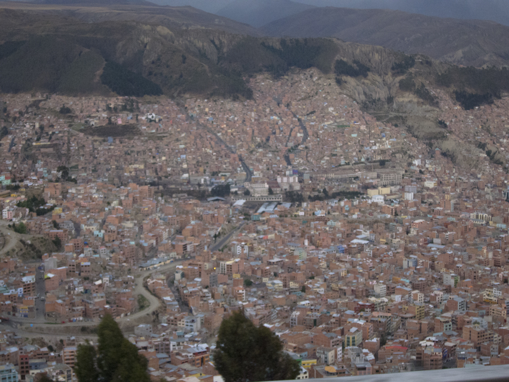
 

But before I get to that (in the next post), we had a few days to discover La Paz (population 2 million), the defacto capital of Bolivia.  As you enter La Paz, you can’t help but be impressed by its size and its geographic location.  First, you pass through the slums that go on as far as the eye can see.  You may think this is the city until you realize you are only on the the rim of the valley in which the entire city is sprawled out.  It was quite astonishing to see this vast city sitting in a “bowl” surrounded by the high mountains of the altiplano. As the city grows, the city climbs the hills, resulting in varying elevations from 3,000 m to 4,100 m (9,840 ft to 13,450 ft).

When we arrived in La Paz we were overwhelmed by the chaos – the people, the traffic, the markets – the city was hustling and bustling at all hours of the day.  The streets were steep, far steeper than any street I walked in San Francisco, and the altitude was high, making for a lot of huffing and puffing as we probed the various neighbourhoods close to our centrally located hostel.
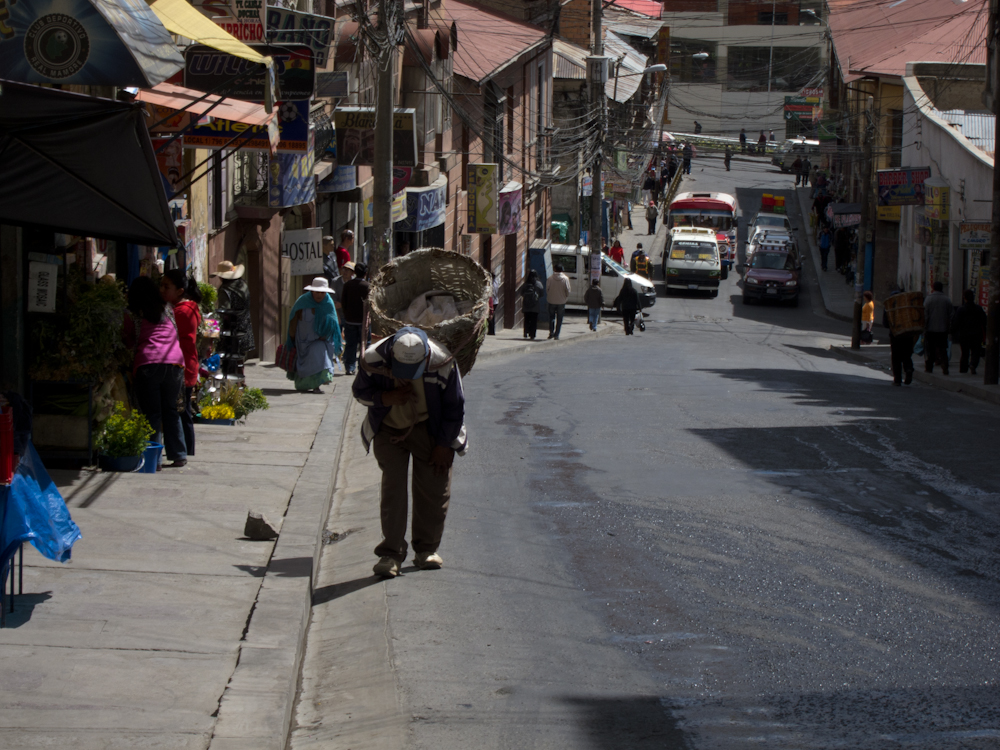
Old man with basket walking up steep street.

Hang on to those bananas!

The city was one of contrasts from modern, imposing high rise buildings to abject poverty as evidenced by the women with very young children, even infants, begging on the streets late into the night, a troubling sight.  Just when you felt you should do something, then you caught sight of another mother on the next corner, and another, and another.  Maybe I’m becoming cynical, but I suspected that these women were strategically choosing their locations to target tourists returning to their hotels after dinner. One could hardly fault these women though.  I’m sure they would have preferred to be in a cozy home with their children tucked safely in bed rather than sitting on the cold side walk begging late into the night. It was a reflection of the suffocating poverty that choked the majority of the population and a visible reminder that Bolivia is indeed the poorest country in South America.

A main boulevard with manicured pedestrian
walkway in the middle.

Typical building in state of disrepair.

A modern high rise.
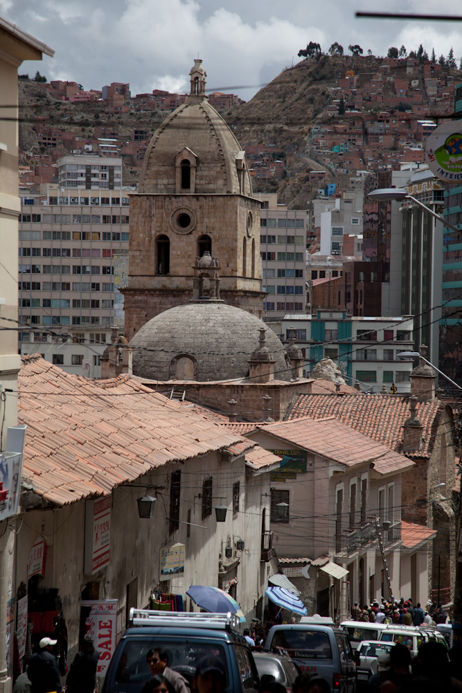
San Francisco Church, founded in 1548 and rebuilt 1784.
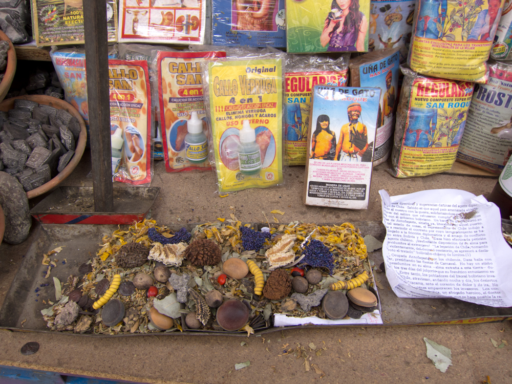
The Witches Market (Mercado de Brujas)

The illusion of a sophisticated city was shattered when we stepped into the side streets and discovered a market offering everything a witch could possibly need, like shriveled llama fetuses, dried frogs, dried armadillos, concoctions of dried plants and teas, and a wide variety of ceramic figures.  It was fascinating to see these strange and exotic objects and one couldn’t help but wonder what they were used for.  Well, why don’t I tell you.

  • Dried llama fetuses:  These are placed under the foundation of a house when it is being built for good luck.  Apparently, an estimated 99% of Bolivian families have a dried llama under their feet.  It’s a good business to be in.
  • Burnt llama fetus (presented on a plate of sweets and herbs): Ensures good luck for a new business venture.
  • Dried frogs: Brings prosperity and if you stick a cigarette in your frog’s mouth, your chances of striking it rich will increase.
  • Bolivian armadillos: Forget ADT Security. Stick one above the entrance to your house, and it will prevent thieves from entering
  • Amulette d’amor (ceramic couple embracing): Use one of these to get hitched although I’m not quite sure how you use it.
  • Naked ceramic couples: These are supposed to improve your sex life, rectify impotency, and increase fertility.
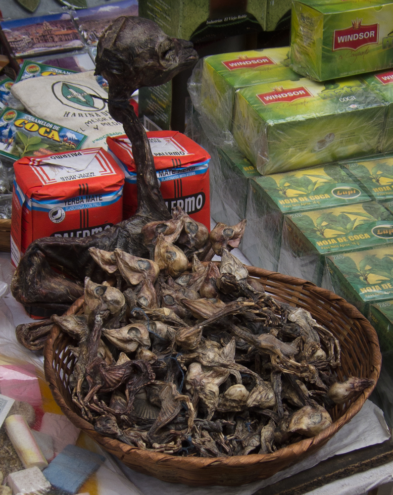
Basket of llama fetuses.

A tray of good luck potions.
(with instructions on the side)

Something for everyone.

Everything a backpacker could possibly want.
One Big Market

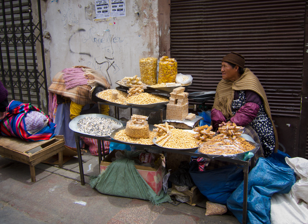
Unlike other towns and cities we have visited, we couldn’t find a central market.  This may be because the entire city appears to be one big market where vendors set up their mats or stalls with their wares covering every inch of every side walk, often spilling into the streets.  Streets were dedicated to certain products or services.  Want a suit? Then visit the suit street.  A pair of shoes for the suit? Yes, go to the shoe street. Some streets just looked like one big flea market with stall after stall of merchandise.  I have never seen so much stuff for sale.  Imagine all the products in Wal Mart laid out on a side walk on small tables and then multiply that by about 50. At times the streets turned into a maze of stalls each leading to yet another street of stalls.  It was easy to get lost amongst the utter confusion.

Closed on Sunday.

One afternoon, we headed in the opposite direction of the tourist district to try to get more of a feel for where the locals hang out.  As we meandered through the maze of stalls, we stumbled upon what we believed to be the black market.  This was where knock offs and counterfeits and all sorts of illegalities were the order of the day. The entire street seemed dark and sinister, like a black cloud had settled over this notorious black market district. People conducted their business in a hushed and subdued manner. Ironically, this market which mainly featured electronic goods was in the shadows of the adjacent street that prominently advertised legitimate electronic goods from well known companies like Sony, Samsung, LG, etc.

Legitimate electronics stores.

Come shopping with us for a few minutes!

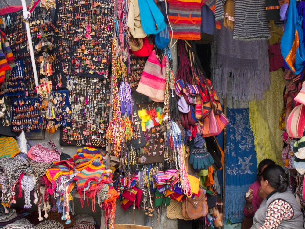
Aside from all the every day products sold on every street corner, La Paz was overflowing with artisan shops targeting the tourist dollar.  We spent some time browsing the kaleidoscope of colorful textiles and purchased a couple of warm hats in preparation for our visit to the Salt Flats.  I also bought a scarf that I just love.  Things were dirt cheap – $3 bought you a warm, hand-knit hat or scarf made of alpaca wool.  We were so tempted to buy a textile wall hanging to ship home, but in the end we decided not to.

Typical indigenous clothing.

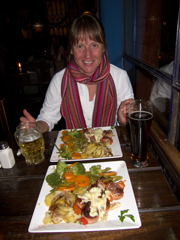
Showing off my new scarf.

A Local Food Fair

Every single meal we had in Bolivia was delicious.  We tended to stick to the tourist restaurants which we don’t usually do, but I think we were ready for some recognizable food.  We ate amazing Indian food that would have rivalled any British curry house.  We thought we had died and gone to heaven as we savoured melt in your mouth bacon wrapped filet mignon brochettes served with potatoes that had been fried in bacon – yes real bacon – and onions, accompanied with a plate full of wonderful vegetables.  We ate mouth-watering pasta and pizza.  I know, nothing Bolivian.  But with such a fine array of international cuisine to choose from, we just couldn’t resist.
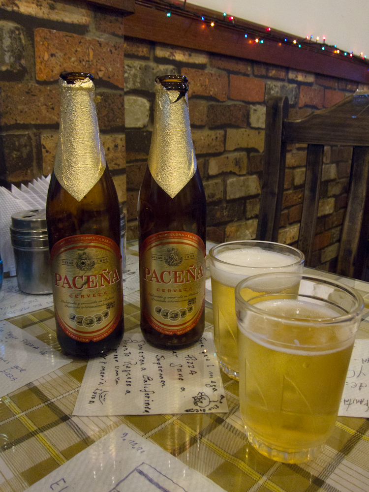
Enjoying the local brew.

We did enjoy one afternoon of cultural cuisine when we stumbled upon a Food Fair which provided a forum for local restaurants to showcase their best cuisine.  This was not a tourist attraction, in fact, we were the only visible tourists amongst the entire crowd.  We stuck to what was recognizable and were impressed with the quality of the food on offer. Throwing caution to the wind, we lined up for something that we couldn’t really recognize, although we could tell it was some kind of meat.  When it was our turn, the servers looked at us skeptically and then suggested they give us just a little taste to see if we liked it. Under their watchful eyes, I took one small bite of the meat and it was all I could do to swallow it.  It was awful!  With a straight face, I offered it to Chris – here honey, you should give this a try. Unsuspecting, he took a bite and I could tell right away that he was ready to gag.  Politely, we handed the plate back to the servers, shaking our head, and with a “no, gracias” and a “sorry”, we gave that place a big pass.  I think they were serving tongue – that was the shape of the meat – although I don’t know whose tongue it was!

Entrance to the food fair.

Fancy vegetable art.

Food samples – yummy!

Dancing in the Streets

It seems South Americans are always celebrating something and La Paz was no exception.  The sound of a marching band in the distance drew us to the location of a local parade in full swing.  This was a great opportunity to legitimately take pictures of the beautiful costumes which we had been admiring on the local indigenous women ever since we arrived.  The smell of booze mixed with urine permeated the street as the parade passed by.  Liquor and beer were being consumed openly in copious quantities by both the parade participants and those watching from the sidelines.  We discovered why the smell of urine is so prevalent in this city – men and boys alike use the side walks and streets as urinals whenever the need arises!

  Dancing in the streets

Money Woes

Our last afternoon in La Paz was spent frantically trying to get money from the notoriously unreliable bank machines.  Only the day before, I had withdrawn the full limit allowed with my bank card so I was surprised that my card didn’t work at any of the dozen or so ATMs we tried the next day.  Chris’ card didn’t work at all, in fact, we realized it hadn’t worked for about 10 days or so.

Finally we contacted our bank to see if perhaps they had put a hold on our cards.  Sure enough, Chris’ card had been frozen since we entered Peru, and mine had just been frozen that day.  What a hassle. And here we had thought the bank machines were at fault.  Well, they were some of the time, but not all of the time.  We got our cards sorted out just before we had to leave for our overnight bus to Uyuni where we would start the tour of the Salt Flats.

Our new toques from La Paz served us well on the
Salt Flats – but more about that in the next post.
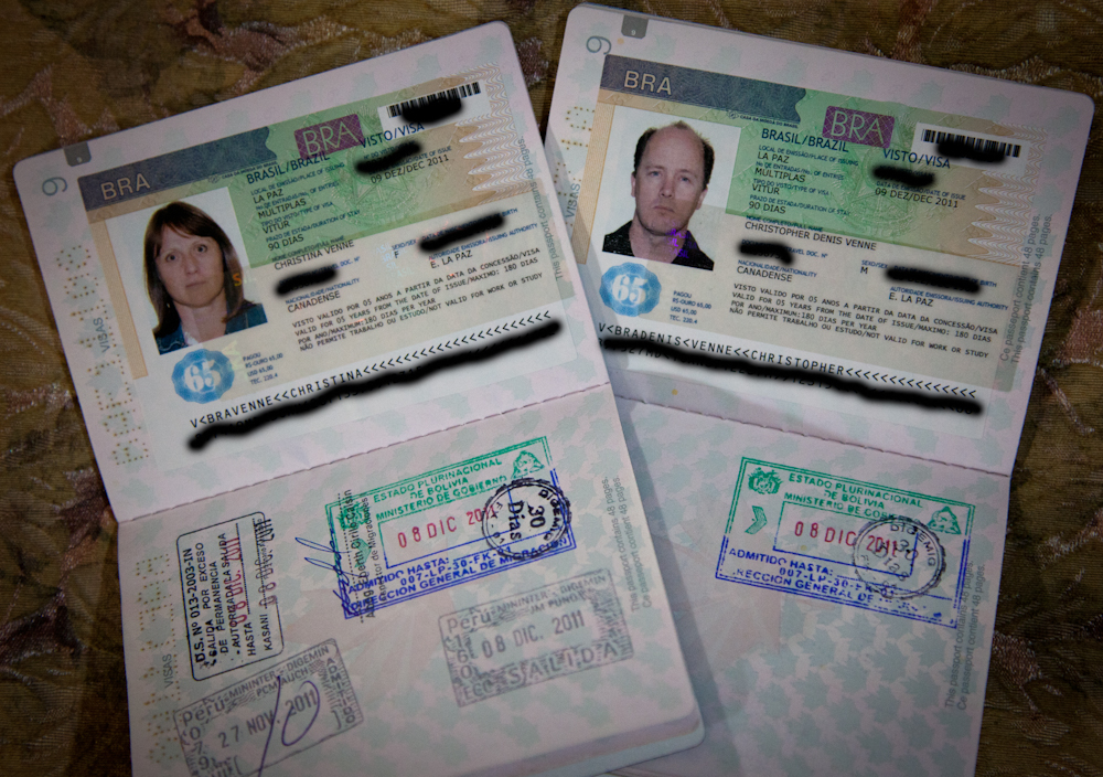
Getting a Brazilian Visa in La Paz

The main reason we came to La Paz was to get our Brazilian visas, a pre-requisite for Canadians travelling to Brazil.  We’re taking our transatlantic cruise from Sao Paola in March, so we needed to make sure we secured our visas in advance.  We anticipated needing a week in La Paz to allow for the visa application to get processed.  There was limited information on line about the process so we didn’t know quite what to expect.

When we arrived in La Paz late Thursday afternoon, we immediately got our paperwork in order for our visa applications and found a place to print and make the necessary copies.  These types of services are provided on every corner of every South American city and town we’ve been in and La Paz was no exception.  There is a significant amount of paperwork required when applying for the tourist visa, including a copy of your airline tickets to show you are intending to leave Brazil (our cruise receipt sufficed), copies of 3 months of bank statements to demonstrate you have sufficient money to visit Brazil, a passport quality photograph (we got these in Canada before we left), a copy of your Yellow Fever vaccination record, and of course, the completed application form and your original passport. The Embassy of Brazil in La Paz website (http://www.brasil.org.bo/ml_vis_tur.php) explains very clearly everything you need for your application.

With our paper work in order, we arrived at the Brazilian Embassy at 9:00 on Friday morning – customers # 0 and 1 in the queue.  We were the first to arrive and the last to leave that morning.  We were told to complete an on line form instead of the paper form on the computer they provided. No problem, it was identical to the paper form we had downloaded and completed by hand so we had all the necessary information at our fingertips (things like where you plan to stay in Brazil, your employer address and phone number, etc.)

We were then asked to wait until an Embassy official could speak to us.  Within a half hour, a very pleasant man named Clovis came out to talk to us, thankfully in English.  He had some questions about our paperwork and was satisfied with our answers.  He asked us when we needed our visas and I said we were in La Paz until they were ready, so hopefully by Monday or Tuesday.  He said he would try to process them that very morning, but first we had to pay the application fee – $65 US each – at the Bank of Brazil which was about 10 blocks away.  He was such an amiable fellow, apologizing to us for such an inconvenience.  We didn’t mind – we had the time, and he was going to process our visas today – so all was good.

We grabbed a cab to the bank, paid the bill in Bolivianos as we did not have enough American dollars and the bank machines did not dispense them either.  The bank was very accommodating – money is money.

Back to the Embassy where we were asked to wait again.  Clovis came back out after about a half hour and suggested we go for a walk and come back at 12:30, before the office closed at 12:45.  We went for lunch and returned just before the office closed.  At 1:00 pm, Clovis came out with our passports in hand – complete with our Brazilian visas in place.  Now, how easy was that!

Crossing the border from Peru to Bolivia by land

We were a little anxious about doing our first over land border crossing from Peru into Bolivia but based on all the research we had done, we felt confident that we had picked the route with the best reputation for easy crossings – Puna to Copacabana.  It was also reassuring to see most of our early morning bus filled with other tourists so we weren’t on our own doing this crossing.

First stop was a few minutes from the actual border where we were told we should exchange our Peruvian soles for Bolivianos. I knew the exchange rates at the border were not the best, but we only had 90 soles to exchange, so it didn’t really make much difference.  I proceeded to exchange all of our soles with the exception of my pocket change which amounted to about 4 soles.  I reserved this as I had read online about a stupid requirement to provide a photocopy of your passport to the Bolivian immigration official, after he had stamped it. And apparently they didn’t have a photocopier handy, so you would have to go find somewhere to make copies.  Turns out this wasn’t required at this crossing, but it was good to be prepared nonetheless.

Speaking of being prepared, the night before, I suggested to Chris that we get a couple of hundred US dollars from the ATM to have with us just in case we needed it – an emergency fund if you will.  Part of the reasoning was that ATM’s are so incredibly unreliable here in South America, we didn’t ever want to be stuck somewhere, low on funds and unable to access any cash.  Especially heading to a new country, who knew what the banking situation would be like.  A case in point:  our bank card did not work on any of the 5 ATM’s in Puno.  We ended up taking a cash advance on our credit card, and we were limited to $100 US at that!  But it turns out that emergency fund was a life saver at the border.

Back to our border crossing saga.  After exchanging our money at less than fair rates, we were then taken to the Peruvian immigration offices.  We lined up in front of one office where the guy looked at our tourist visa, and stamped it.  We then lined up in the building next door to get our passports stamped by the immigration official.  Since several buses had arrived at the same time, there were lots of people getting processed.  Our bus assistant, Jose, was very helpful making sure everybody from our bus went to the right line ups.  Surprisingly, the lines moved quite quickly.

When it was our turn to get our passports stamped, I could tell right away there was a problem.  The two officials whispered to each other, then asked us if we spoke Spanish.  I said a little, and then he told us in English that we must pay a tax.  Why, we asked.  We had overstayed our visit in Peru.  That’s ridiculous, we said,  we’ve only been in Peru for 11 days, we’re allowed to stay much longer.  Not so, they said, as they pointed to a “10” scribbled by hand on our tourist card that we received in Lima at the airport.  Apparently, the “10” meant we were only allowed to be in the country for 10 days. We thought they were trying to pull one over on us, so we argued with them that the regulations permitted us to be in the country for at least 60 days. After a few minutes of arguing that wasn’t getting us anywhere, I asked – how much is the tax anyways?  $1 for every day over the limit.  I quickly did the math and realized we were only over by 1 day.  Well that meant $1 for each of us.  No big deal.  We’ll pay the tax even though we think we shouldn’t have to.

Peru Immigration Office (where all the fuss occurred).

As soon as I agreed to pay the tax, they said if I wanted to pay them, it would cost an additional $10 each, but we could go to the bank and pay the $1 tax, get a receipt and then come back to get our passport stamped. Where was the bank?  They pointed outside, to the left.  We found our bus attendant Jose (the guy in the blue striped shirt in the picture above) and asked him if he could help us out, plus we wanted to make sure the bus and our packs didn’t leave without us.  He said we could take a taxi to the bank – it was just a few minutes away – but the bank was closed.  Great.  That was helpful.

So we had no choice but to go back into the Immigration office.  Jose came with us to try to hurry things along. While we were going through this, another guy was also pulled aside and they were trying to get $15 out of him. I asked the Immigration officer if we can pay in Bolivian soles – no, only Peruvian soles or American dollars. Well, we just exchanged all our money to Bolivian soles.  We did have our $100 US emergency fund but didn’t want to play that card yet.

For some reason, the guy then reduced our fee to $1 each (maybe just to shut us both up and get us out of there or maybe he thought we didn’t have the money to pay the fine).   I offered my 4 soles, but he insisted it should be 6 soles.  I pulled out 2 american dollars in coins but they wouldn’t accept this either -had to be bills.  Finally, we took out a $20 US bill, and asked for change – which surprisingly they gave to us.  All I can say is thank goodness we had that emergency fund as I’m not sure what would have happened otherwise.

Unfortunately, the other fellow was not so lucky.  I think he really pissed them off when he took his camera out and threatened to take pictures.  He was forced to pay the full amount if he wanted out of the country.  All three of us were convinced we had been scammed by corrupt officials.

We finally got our passports stamped so we could leave the country.  We then walked over to the Bolivian side and got our passports stamped again along with a 30 day tourist visa (we checked this time).  Aside from the tax “scam”, the crossing was really simple.  We left our bags on the bus, and the bus met us on the Bolivian side.

The road to Bolivia.

Crossing the border.

We’re in Bolivia!

Another line up for Bolivian customs which were a breeze.

And now for the part of the story I hate to admit…….we were wrong!  Apparently, when you enter Peru, the amount of time you are allowed to stay is at the complete discretion of the Customs Officer who processes you at your entry point – the Lima airport in our case. They normally give 30, 60 or 90 time limits, but in our case, they only gave us 10 days.  I think the guy must have been in a bad mood or something.  It turns out that if you exceed the time you are permitted to be in the country, you have committed a criminal offence.  That’s right. We were criminals as far as the Peruvian officials were concerned.  It is well documented that the $1 a day tax is the levy imposed for such criminal behaviour. However, the $10 fee that was waived is clearly not an official tax.  I don’t know how I missed all this information in my research before we entered the country.  I am usually quite thorough, reviewing our government’s website as well as registering our whereabouts with Foreign Affairs.

But here’s the thing.  When you’re being rushed through customs on entry, the guy is looking at your passport and tourist card, then quickly stamping everything and scribbling something on your tourist card and waves you on.  You think everything is fine, however, it’s the scribble on the tourist card that indicates how many days you are allowed in the country. If that number does not align with the number of days you plan to be in the country, then you must ask the official to change the number.  Hopefully he agrees because he doesn’t have to change it. As soon as you walk away from his desk, that number is sealed and you have no opportunity for recourse – you must leave the country within the number of days on your card or you become criminals, like us.  Unfortunately, it was these finer details that alluded us.  Still, I feel quite bad about losing our cool with the officials when we were exiting.  Aside from the extra $20 “administration fee” they were trying to scam coerce out of us, they were really just doing their jobs and following their rules.

For me this was a good lesson.  We need to be extra diligent reviewing the entry and exit requirements of each country we visit.  And we need to keep our cool even if we think we’re being scammed by corrupt officials.  A small reserve of American dollars can go a long way to getting you out of a pickle.  At the end of the day, I think it’s better to pay off the official rather than end up in jail, or worse.

Travel Tip:  When entering Peru, check the number written by the Customs Agent on your tourist card.  If it doesn’t cover the number of days you plan to be in the country, ask, beg or plead with the agent to change the number.  Otherwise, be prepared, on exit, to pay a tax of $1 per day you exceed your limit.  Don’t kick up a fuss, just pay the damn tax.

Travel Tip:  When travelling in South America, be prepared in case your debit card does not work at any of the local ATM’s.  Some suggestions:

  • Try to get money before you really need it, for example, the day before you need to pay your hostel bill.  This way, you have a couple of days to try to get money from the bank machines. There is no rhyme or reason when your card will work.  One day it works; they next day it doesn’t.  One hour it works; the next hour it doesn’t.
  • Carry a Mastercard or Visa credit card with you for emergencies.  This has saved us more than once when we just couldn’t get our debit card to work.  It’s expensive to take cash advances – a hefty $7.50 transaction fee is not uncommon, plus any fees your credit card company tacks on for the international transaction.
  • Carry a small reserve of American dollars for emergency purposes, including paying off corrupt officials.  At least you’ll be able to stay out of jail, or pay your hostel bill before leaving town.
Stay tuned for our next encounter with government officials – this time with the Brazilian Embassy in La Paz.  Things didn’t turn out at all the way we thought they would.

Interested in learning a little bit about Bolivia – where it is, its currency, a little about its geography and economy and a few other interesting facts?  Follow the “Bolivia” link on the top left side of the website under “Where are we now” or just click here to make it easy.

Puno was a bust

Puno, Peru is situated on the shores of Lake Titicaca, which sits 3,811 m (12,500 ft) above sea level, making it the highest commercially navigable lake in the world. It also happens to be the largest lake by volume of water in South America. Lake Titicaca is most noted for its unique islands. Uros is comprised of a group of about 44 artificial islands made of floating reeds. Amantani and Taquile are a couple of other islands renowned for their culture and history.  There are several islands on the Bolivia side of Lake Titicaca, Isla del Sol and Isla de la Luna which are equally interesting.

We travelled to Puno on Monday with plans to visit one or more of these islands.  We had read warnings on line and in our travel book that these islands were becoming more and more touristy to the point that the culture and traditions of the indigenous populations were being eroded.  We usually avoid the tourist trap venues as much as possible, preferring to do things on our own and a little off the beaten track.  We made an exception here because it was practically on our way to Bolivia, and we still felt there was merit to visiting these islands.

Our first impression of Puno was that it was a small city like any other in Peru; nothing really distinguished it as special or different.  Our hostel provided basic, comfortable accommodations, but again, nothing out of the ordinary.  We did notice that there were many indigenous women dressed in their traditional costume – long, pleated skirts, shawls and a bowler hat perched on the top of their heads – I wondered how these stayed on, especially on a windy day!  All the indigenous women had long thick braids down their back, and many had lovely pom pom accessories attached to the bottom of their braids.

After hearing the experience of a couple of young lads at our hostel who just happened to be from Barrhaven in Ottawa (just a few kilometres away from our old house), we decided we would visit the island of Uros on our own and then decide after that what we wanted to do. Rather than take a packaged tour, we opted for the public ferry that took us to the islands for 15 soles each. We were the only foreigners on the boat – just the way we like it!

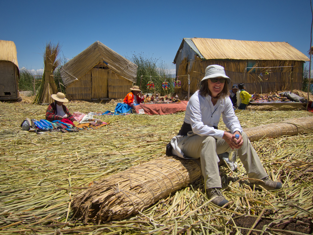
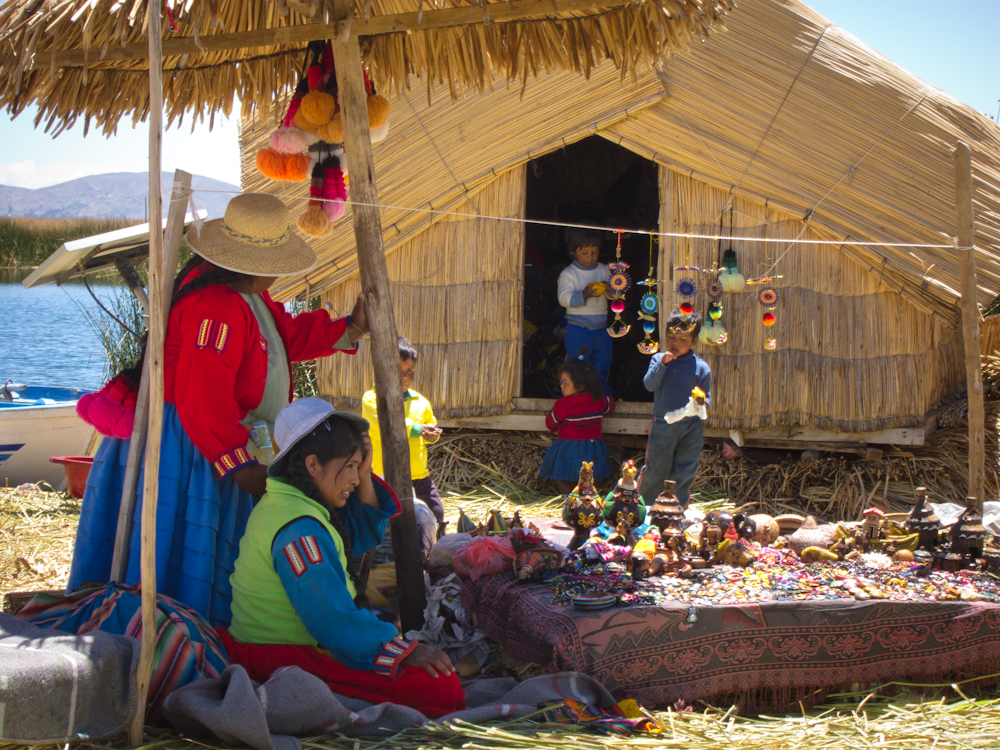
As we approached the islands, it looked like a scene from a theme park – so contrived, so fake, so touristy.  Once we landed on a very tiny island, we were forced to listen to a man tell us about the island and the families that supposedly lived on them (which they did at one time, but it didn’t look like anybody was living on the island we visited because the little huts were being used solely for the storage of the junk they were trying to pawn off on tourists).  While he was giving his spiel, a few women started to organize their craft tables so that when he was done, they were open for business.

Nobody in our group seemed too interested in the overpriced trinkets.  It was interesting to see how the islands were constructed and how it felt to walk on the reeds.  But it was such a tourist trap, we were completely turned off from the entire experience.   

We did pay an extra 5 soles to take a reed boat to another floating island which gave us a good chance to take some pictures.  And we had a delicious lunch on one of the islands – fried trout (from the lake) with rice and potatoes. Throughout the entire experience we felt as if we were being held hostage until we bought something.  It left a bad taste in our mouth.

Based on this experience, we decided we didn’t need to repeat it on any of the other islands.  And so it was an easy decision to leave Puno the next day.  We considered stopping for a couple of days in Copacabana which sits on Lake Titicaca in Bolivia, but after reading similar reports of it being a tourist trap, we opted to head straight for La Paz instead.

Self-guided hike into the Colca Canyon = panic attack

Day 1 – Arequipa to the Oasis

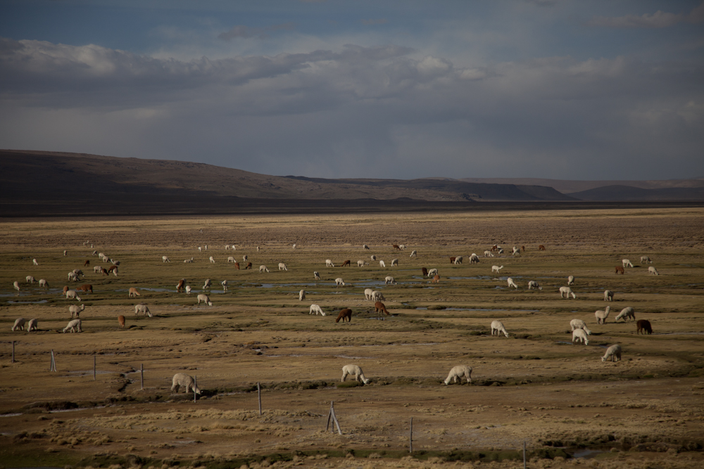
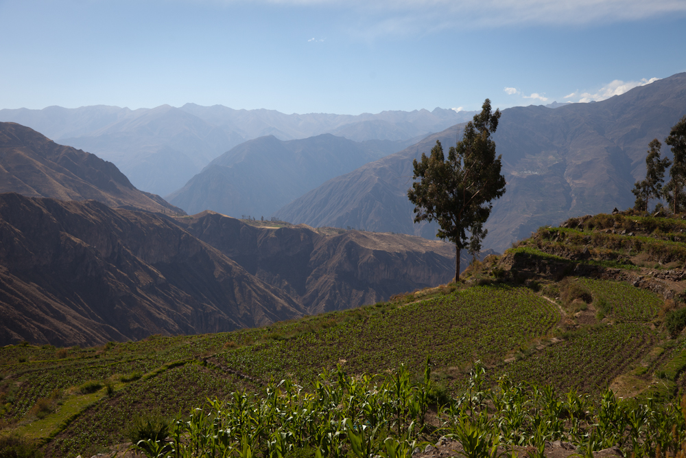
Last Tuesday morning, we took the 8:30 am bus from Arequipa to Cabanaconde where we would begin our hike into the Colca Canyon.  The 5.5 hr trip went quickly as we sat back and enjoyed the scenery.  We passed mountains and valleys dotted with herds of cattle, sheep, alpacas,and llamas.  The valley, and parts of the canyon are habitable, and Inca and pre-Inca terraces are still cultivated along the less precipitous canyon walls.

We arrived without incident in the dusty, sleepy little town of Cabanaconde (3,287 m) and promptly headed to the hostel we were planning to stay in at the end of the hike.  We talked to the owner and a few other hikers to get more information about our hike and to confirm there was sufficient time to make it to the bottom of the canyon that afternoon – supposedly a 2 hr hike – where we would overnight in what was called the “Oasis” (2160m).

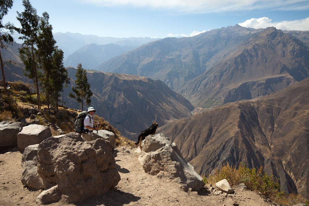
We began our descent at about 3:00 pm with very simple directions:  take the road across from the church, follow it out of town and stay on it to the bottom. Before we even left town, a friendly German Shepherd dog joined us and accompanied us all the way down to the bottom. As we left town, we enjoyed the beautiful scenery of fertile, cultivated terraces.  The rocky path followed a gentle slope that lulled us into thinking this was going to be a piece of cake.

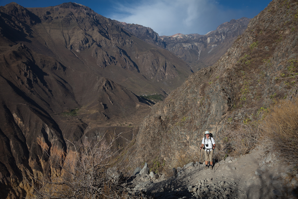
And then we came to the edge of the canyon and got our first real look at the trek ahead. It was a long way down, and it was very, very steep.  In fact, we couldn’t even see the bottom.  To make matters worse, the trail was comprised mainly of loose rocks the size of our fist, mixed with gravel and larger rocks we had to navigate around.  This wasn’t going to be easy.

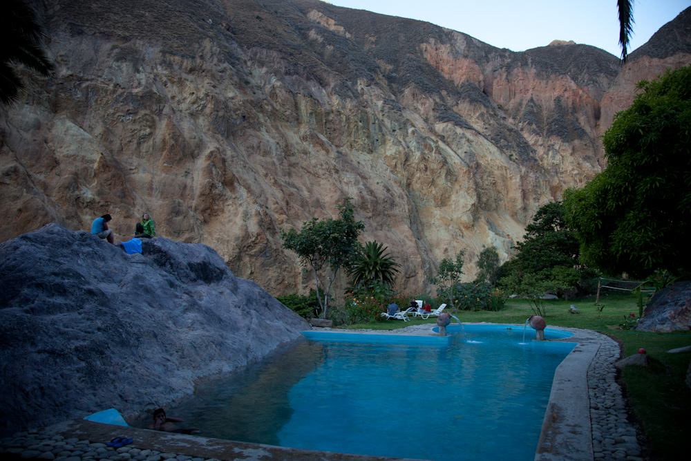
As Chris took his time taking pictures along the way, I hiked on ahead. After a couple of hours, it was clear we still had a long way to go and I was getting concerned about losing daylight.  Finally we could see a tiny patch of green called the Oasis – it was just a dot way down below.  As we inched our way closer going back and forth along the steep switchbacks, we could see the “resorts” and their swimming pools.  Oh, how we wanted to get to the bottom!

After more than three gruelling hours, we reached the Oasis with burning leg muscles and only a half hour of daylight to spare.  Once at the bottom, we picked the hostel we had been oogling through our binoculars for the last hour of our descent, the one with the pool that had a huge rock face protruding from one side.

We arranged for our room (10 soles each = $3.75 CAN each), took a quick shower in the very primitive bathroom and then dove into the pool.  It was so refreshing, but with the sun fading, the outside temperatue was also dropping fast.

After a quick swim, we washed our clothes and joined the other hikers for a communal dinner. There were three tour groups staying for the night and a young couple who were hiking independently like us. Dinner consisted of a potato based soup, followed by a huge plate of spaghetti noodles topped with a tomato and onion sauce. We were hungry and it all tasted delicious. Dinner cost 10 soles each,  a large beer cost 10 soles, 2 cokes cost 10 soles – this was beginning to look like a pattern.  How much? Oh, what a surprise, it costs 10 soles.

Our mud and bamboo hut offered very basic accommodations – a bed on a concrete floor.  No lights.  No electricity.  We fell asleep at 8:30 pm and slept like babies all night.

Day 2 – The Oasis to San Jan

In the morning, Chris mentioned he experienced vertigo for the first time in his life on the descent and it scared the crap out of him.  He was terrified he was going to slip and fall over the side of the cliff. Out of nowhere, he had developed a fear of heights! Even more surprisingly, I felt no fear whatsoever – it was as if my fear of heights had transferred to Chris.  I asked him if maybe he was getting sick, a cold perhaps that could be causing some inner ear issues and thus putting him off balance.  He said he felt fine except for the vertigo.

Chris was reluctant to continue the trek, but that would mean going back up the way we had come down the previous day, something I did not want to do. We discussed the options and finally agreed to continue the hike as planned, but to bypass the more remote town of Tapay; this would cut the day’s trek in half to about 3-4 hours. After a very basic breakfast – one fried egg and two dry buns – we headed out at 8:30 am.  The most difficult part of this day’s hike would be the ascent on the other side of the river.  Our legs were already sore from the previous day, but at least we would wear out different muscles as we ascended. Chris was still grumbling about falling off the side of the mountain so we took it nice and slow and headed down towards the river where we crossed a suspension bridge.

On our way down, we passed one of many aqueducts.  I was impressed with the ingenuity of the creators of these water systems that diverted water from higher sources such as waterfalls down towards the canyon valley, providing irrigation for the towns and agricultural terraces.  It seemed pretty clever to me and I suspected these waterways have been around for a very long time. As a result, the valley was so lush and tropical in stark contrast to the arid, desert like mountains above.

It was a relatively easy hike down to the river. Chris was still taking pictures so I took that as a good sign – at least he could distract himself. I think he had resigned himself to his ultimate fate – which of course in his mind was his demise in this remote canyon.


I wasn’t quite sure how to deal with Chris as I had never seen him act this way.  I understand the power of irrational fear, but I also know how to manage my own anxiety so as not to inflict it on everybody else.  But I guess I’ve had years to practice this skill, and Chris was hit with a level of anxiety and irrational fear that he had never experienced before.  And so he let me know how terrified he was – often.

To be honest, Chris’ fretting was starting to get on my nerves, so once we crossed the river and began our ascent, I hiked a little faster to create some distance.  I knew he would be fine, as there was no real danger. These paths had been servicing humans and mules for hundreds of years and I think it was pretty unlikely we were going to fall off the side of the mountain.  But there is no point trying to talk reason to someone in the grips of an anxiety and panic attack. Sometimes it’s just better to stay quiet….and to walk ahead.   I should add a side note here.  After the hike, Chris did some research and apparently people have died falling off the side of cliffs in this canyon and some people have just gone missing.  I’m glad we didn’t have that information beforehand.

Once we finished the ascent on the other side, the path flattened out and hugged the side of the mountain – vertical rock face to the left, and to the right, a sheer drop off to the canyon far below. The path was about 3-4 feet wide in most places. Whenever I looked back, I saw Chris hugging the inside rock face, often hanging on with his hands like his life depended on it.  I found this part of the trail to be the easiest and offered spectacular views that you could at least enjoy.   We had perfect weather each day, sunny and clear.  In the valley it was very hot, but as we gained altitude, the temperatures were more moderate, around 20C would be my guess. Still, the sun was intense and there was little shelter from it along the trail so during the mid-day, it was quite brutal.  At night the temperatures dipped, probably to about 10C – perfect sleeping weather.

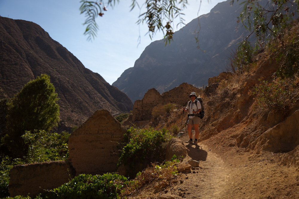
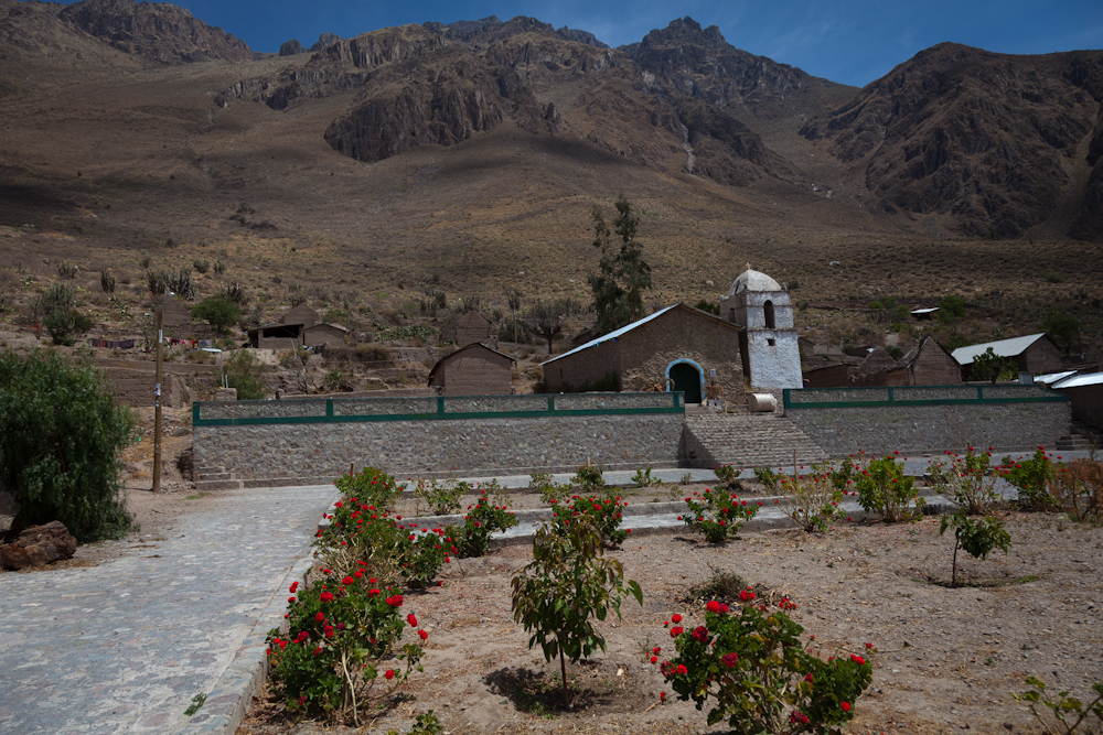
We passed through two very primitive villages that were eerily quiet and still with only a few people in sight.  Where was everybody? Many buildings laid in complete ruin, while others looked like ruins but were inhabited as evidenced by the electricity running to them; one even had a satellite dish.  And of course, each town had its own modest church.


At this point, we could see the north side of the canyon where we would be ascending the next day. Chris had been fretting about this ascent since we woke up, and now that he saw the vertical rock face, he was close to hysteria.   I have to admit, the rock face did look daunting.

“Mount Doom”

The final leg of this day’s trek required a very steep descent to cross another river followed by an easy hike to San Juan.  Chris inched his way down the mountain side at a painstakingly slow pace.   Here’s a photo that I took the following day when we were climbing on the other side.  It shows the zig zag line of the descent and I think it gives a pretty good idea of how steep this part of the trail was.

When we arrived at San Juan, we picked our hostel, Posada Gloria, based on a random recommendation made by an old man we passed in the last town.  Gloria’s place looked as nice as any, so we figured why not.  We had lunch – alpaca mixed with tomatoes and onions, with rice and french fries. This was our second time eating alpaca and this time it tasted a little gamey.  But we were hungry so we polished off our plates without complaint.

After lunch, Chris sat in a patio chair and stared at the imposing rock face on the other side. I asked him if he was going to just sit there all afternoon and fret, and sure enough, that is what he was planning to do.

I tried my best to distract Chris that afternoon but he was pretty focused on the cliff that was staring him in the face.  I had never seen Chris like this and I was now starting to worry about him.  What if he became a self-fulfilling prophecy and actually did fall off the rock face? I decided not to share with him a technique I often use to manage my own anxiety which is to consider the worse possible outcome and to get comfortable with it.  I didn’t think it would be very helpful for him to imagine himself slipping and hurling down the side of the cliff, landing in a crumpled ball, dead.  Nope, that wouldn’t be helpful.  So I continued my strategy of distraction although I was running out of ideas in this remote little mountain village that was comprised of nothing more than a few humble dwellings.

Rooms with a view – a view of “Mount Doom” that is!

At 7:00 we ate dinner – a delicious vegetable curry with rice.  The lady in this hostel, Gloria, really knew how to cook.  By now it was pitch dark and the sky was illuminated with myriads of bright stars. It was really beautiful. We went to bed early in our very primitive accommodations – check out our stone floor; I again slept like a baby throughout the night but Chris was up half the night – he just couldn’t get a grip.

A stone floor – didn’t have to worry about getting it dirty!

The bathroom and shower facilities were super clean and the water was hot.  
What more could you ask for?

 Day 3 – San Juan to Cabanaconde

As I sat across from bleary-eyed Chris over breakfast, listening to his incessant rant about how terrified he was about the day’s ascent, it dawned on me that this could turn out badly because Chris was so wound up.  I suggested we hire a mule to carry Chris’ pack. He resisted the mule idea – the male ego was still intact in spite of the anxiety – only to concede when I pointed out that we would be contributing to the local economy.

Gloria, the hostel owner,  found us a mule – it would cost 60 soles to carry Chris’ pack, and another 10 soles to carry mine.  For 10 Soles (about $3.75 CAN), I figured I should also do my part to support the local economy and to help protect my husband’s wounded ego.  The mule turned out to be the best decision I have made on this trip thus far, something that Chris kept muttering all the way to the top – thank God for the mule, thank God for the mule.

We set out with our mule, Peter, and our mule owner, Jorge.  After dealing with Chris’ meltdown for the past 24 hours, I wanted to get of the canyon just as much as he did.   While I was a little testy at the beginning of the hike, at a certain point I decided I would do whatever I could to support him up the mountain which basically meant keeping two feet in front of him and offering words of encouragement and promises that we were almost at the top (don’t forget he wasn’t looking anywhere but at his feet, so he had no idea how far we had to go.)

It was a pretty tough hike for most of the way although the path did flatten out for stretches at a time offering the chance to take in the spectacular scenery.  From this vantage point, we could see where we had hiked the day before – the towns were little dots on the other side of the canyon, and the paths looked like pencil lines etched into the side of the mountain.  I kept wanting to stop and take it all in, and to take pictures but Chris freaked out every time I stopped – he was practically in a trance just concentrating on my feet ahead of him, not daring to glance down.

The rocky path out of the canyon.

A view of the two towns we hiked the previous day.  

Previous day’s path into and out of the Oasis.

Finally, we reached the top and Chris literally kissed the ground with utter relief.  We still had a few kilometres to walk into town, but the worse was behind us.  Chris has vowed he will never, ever do a hike like this again.  And I believe him.

One final note:  We returned to Arequipa that same day and by evening, Chris was suffering from a head cold.  I wonder if his vertigo was at least caused in part by some congestion or inner ear inflammation.

A week of history and culture with a twist of terror

Arequipa, the second most populous city in Peru with a population of 836,859 boasts an historic centre that was named a UNESCO World Heritage Site in 2000 in recognition of its architecture and historic integrity. The city sits at an altitude of 2,335 m (7,661 ft) above sea level, at the base of a former snow-capped volcano called El Misti which has an altitude of 5,822 m (19,101 ft) above sea level .

We limited our visit to the historic center of Arequipa which probably doesn’t accurately reflect the city as a whole.  Still, we found Arequipa to be reminiscent of a vibrant European city, rich in culture and heritage. The city is very clean and we felt safe walking the streets both day and night.  We enjoyed picture perfect weather every day – sunny and about 20 Celsius.  Here are some of the highlights of our week in Arequipa.

Silence, please!

The Santa Carolina Monastery was built in 1580 and later expanded in the 17th century.  It was built with sillar, the white volcanic rock that gives Arequipa the name of the White City, and ashlar, petrified volcanic ash from Volcan Chachani overlooking the city. Located just three blocks from the central square, Plaza des Armas, it was easy to find this walled city within the city.

This is a monastery of nuns of the Domincan Second Order.  At it’s peak, there were over 450 people living in the monastery; today there are only about 20 nuns living in the northern corner of the complex, cloistered away from curious tourist eyes.

When researching the monastery before our visit, I was surprised to learn the monastery only accepted women from upper class Spanish families who had to pay a generous dowry – basic admission was the equivalent of $150,000 US in today’s dollars for their daughter’s admission into the monastery.  This monastery was more like a rich girl’s boarding house rather than a convent; each nun brought with her 1-4 servants, and indulged in the same lavish lifestyle she was accustomed to when growing up.   The nuns gave parties, had musicians in to entertain them, and enjoyed fine china, crystal, silk rugs and curtains.  This sure isn’t the picture one conjures up when imagining a monastery in the 16th century! However, the good life came to an abrupt end for the nuns when the Pope caught wind of their shenanigans and sent Sister Josefa Cadena, a strict Dominican nun, to straighten things out in 1871. She sent the rich dowries back to Europe and freed all the servants and slaves, many of whom decided to stay on as nuns themselves.  She instituted internal reforms and transformed the monastery from its country club status to a real monastery where the nuns genuinely renounced the world and embraced a life of poverty.  I bet those nuns didn’t know what hit them!

In the 1960s, the monastery was struck twice by earthquakes, severely damaging the structures, and forcing the nuns to build new accommodation next door. It was then restored and opened to the public. This also helped pay for the installation of electricity and running water, as required by law. It is now one of Arequipa’s prime tourist attractions.

As I walked through the alleyways and courtyards, into the private nun’s chambers which they call cells, it was easy to imagine what life would have been like in this cloistered community hundreds of years ago.  It was so peaceful and serene.   There were nooks and crannies around every corner, stairs leading nowhere which now served as plant stands, and sky lights bathing dark corners with natural light.  Solitude would have been a constant companion, except when you were having parties of course.   I could picture myself living in such an environment….for a few days at least.  After that, it would probably get on my nerves.

More photos of the Monastery of Santa Carolina
%%wppa%%
%%slide=2%%
%%size=400%%

Plaza des Armas

South American towns and cities typically have a central park or plaza; Arequipa’s Plaza des Armas is one of the most beautiful we have seen thus far.  It reminded me of the plaza in Cusco.  Under a background of majestic, snow capped mountains, the plaza is surrounded on three sides by colonial arcaded buildings which are home to many upscale restaurants and cafes, some with charming second story balconies overlooking the square.  The north end is dominated by the impressive, twin towered Cathedral which was founded in 1612.  A large water fountain flows in the center of the square. The plaza is always crowded and bustling with locals; we have seen very few tourists around town.  On Saturday night, we saw three wedding parties being photographed in the plaza (unfortunately we didn’t have our camera at the time – I really hate it when we do that!)  Hundreds of pigeons have made the plaza their home and children love to buy bird feed from local vendors to feed the friendly pigeons. Surprisingly, the plaza is very clean in spite of the huge flock of resident birds.  The plaza was a great place to take a break on a park bench and just people watch.

More photos of the Plaza des Armas as well as street scenes around the Plaza.
%%wppa%%
%%slide=3%%
%%size=400%%

Churches, churches, churches

Like every South American city we have visited, there was an abundance of churches in Arequipa, the vast majority of which are Catholic.  I have to admit that after a while, the churches all start to look alike, at least in our memories.  Still, one feels compelled to at least visit the most outstanding churches.

Of course the Basilica Cathedral of Arequipa occupying the entire north end of the Plaza des Armas was not to be missed.  The construction of this cathedral began on the very day the city was founded: August 15, 1540.  Imagine, less than 40 years after the church construction began, it was reduced to rubble by an earthquake.  In 1600, when the church was almost completed for a second time, another earthquake caused some serious damage, followed by yet another earthquake in 1604 that reduced it once again to rubble.  In spite of its sad history of destruction caused by one earthquake after the other, the most recent being in 2001, today the imposing cathedral stands erect and intact, a testament to the Arequipenos’ determination to protect its most precious church.

A slideshow of the Basilica Cathedral:
%%wppa%%
%%slide=4%%
%%size=400%%

We wandered into several other churches in the historic district but didn’t even take note of their names.  Yes, I guess we’re experiencing church fatigue – maybe you’re getting sick of all the church pictures too.

A slideshow of other churches we saw in Arequipa:
%%wppa%%
%%slide=5%%
%%size=400%%

To market, to market ….

I love going to local markets, the non-tourist kind that sell fruits and vegetables and all kinds of interesting and weird things, just wandering amongst the vendors, immersing myself in the hustle and bustle, catching a glimpse of everyday life of the locals, and shocking my senses.

On Saturday morning, Chris was sick with a head cold so I decided to venture out on my own in search of the the Mercado San Camilo, located between our hostel and the plaza, according to my map, on the Av San Camilo between Av Pierola and Av Peru.  I had some difficulty finding it at first as I thought it would be an outdoor market, perhaps because all the markets we visited in Ecuador were outdoors.  I wandered around the busy streets (I think everybody was out shopping on Saturday morning), and was surprised to see the many Christmas stores stocked to the brim with tacky Christmas decorations just like any Canadian dollar store in December.  I finally found the unmarked entrance to the market which was housed in a large building.

This was a typical market that sold everything from chicken heads (I took a picture because I didn’t think anyone would believe me otherwise) to sombreros.   The market was very well laid out, with overhead signs advertising the various sections – fruits, vegetables, meat, fish, textiles, clothing, etc.  I was most intrigued and equally grossed out by the meat section.  As I walked down one row after another of unrecognizable meat parts, at a certain point I couldn’t stop to take any more pictures as I was overcome by the stench of raw, unrefrigerated meat.  I still managed to snap a few shots of strange delectables, at least I assume Peruvians think of them in that way.

Later that day, I returned to the market to purchase some fruits and vegetables as we decided we would prepare our own food for the next couple of days while Chris recuperated.  I purchased a large bag of vegetables – brocolli, green onions, red pepper, tomatoes, coriander, garlic, carrots – all for under 10 soles (about $3.75 CAN).  Compare this to the Starbucks coffee I bought in the morning (I figured it would cheer Chris up which it did) at a ridiculous price of 8 soles each ($3.00 CAN).  It was the first coffee in three months that resembled our coffee at home and it was our first cup of real coffee since arriving in Arequipa.  As we savoured every sip, we both agreed it was worth every sole.

A slideshow of what I saw on the way to the market and some of the more interesting finds in the market:

%%wppa%%
%%slide=6%%
%%size=400%%

And now for some culture

While wandering around during the day on Saturday, I saw an advertisement for a concert in the Municipal theatre scheduled for 7:00 in the evening: Tuna Mejor de Arequipa.  I was ready for some culture and was prepared to go alone but Chris insisted on coming along even though he was still sick; he was concerned about me being out at night alone even though I had assured him I would take a taxi back.  I think it was good for him to get cleaned up and out of the hostel for a couple of hours.

Unfortunately, we didn’t bring our camera with us (I hate it when we forget our camera or even worse as was the case that night, when we consciously choose to leave it at the hostel) and so I’ll just have to describe the evening for you (I’ll try to keep it brief).  The show was scheduled to begin at 7:00; we arrived at 6:35 with plenty of time to spare. The show began at 7:45.

We were entertained for two hours by a group of 18 men, ranging in age from about 18 to 60+.  They were standing on the stage in three rows: 8 men in the back row playing various sizes of guitars; 6 men in the middle row playing mandolins, and 4 men in the front row – two with percussion instruments, one waving a flag, and the main singer.  All were dressed in a traditional costume comprised of a large black and red cape adorned with flowing colorful ribbons over a puffy white shirt, black pants to the knees, black knee socks and black shoes.

Based on the reactions from the audience, the majority of whom were 60+, I suspect the songs were traditional oldies, some of which were specific to Arequipa. It was all good fun, with the audience singing along, clapping their hands, and waving their arms in the air back and forth as if they were in a rock concert.  An announcer introduced each song but we didn’t understand a word.  During intermission, we were entertained by two young dancers clothed in traditional costumes, dancing a traditional Spanish dance. It was much better when they finally turned the stage lights on – guess the light guy was taking a break too.

Here’s a video from a similar performance by the group in 2007 – not the best video but it will give you an idea of what the show was like.

http://www.youtube.com/watch?v=8ahqmyxRWAA&feature=related

 Hiking in the Colca Canyon

Last but not least, we spent three days hiking into the Colca Canyon without a guide. At a depth of 4,160 m (13,650 ft), the Colca Canyon is twice as deep as the Grand Canyon, although the Colca Canyon walls are not as vertical.  It is considered the second deepest canyon in the world; the deepest canyon, Cotahuasi Canyon is just up the road.  Maybe you’ve already thought of this, but it didn’t occur to us until we started our first descent to the canyon floor – anyone with issues with vertigo or a fear of heights may have trouble doing this hike.  I’ll tell you all about this harrowing experience in the next post.

We’ve arrived in Arequipa

After a major flight delay that caused us to stay overnight in Lima (compliments of LAN), we arrived in Arequipa this morning under clear, blue skies and warm temperatures.  The 12-hour delay in Quayaquil offered us some down time (in a luxury hotel also compliments of LAN) that we used to plan out the next part of our South American journey.  We now have a high level idea of where we will be going and what we will be doing for the next 3-4 months and we’re very excited about this next leg of our trip.

When we we were in Peru two years ago, we visited Lima, Cusco, and Iquitos; we spent a week in the Amazon jungle and hiked the Inka Trail to Machu Picchu.  This time, we will focus on the southern region around Arequipa and Lake Titicaca which we missed completely the first time around.  After a couple of weeks in this region, we will travel by bus to Bolivia where we have two primary objectives: first secure our Brazilian Visas, and second, visit the salt flats.  We will continue south by bus to Santiago, Chili.  From there, we will fly to the most southern town of Chile, Puntas Arenas where we will spend a couple of weeks hiking in the Patagonia mountain range.  Next we head to the port town of Ushuaia, Argentina – the debarkation point for Antarctica cruises. We are still undecided about this because of the exorbitant cost (prices start at $8,000 per person!).  Hopefully we can snag a good last minute deal that won’t break the bank.

We will then head north, doing some more hiking on the Argentinian side of the Patagonia mountains and ending up in Buenos Aires for a couple of weeks.  Iguazu Falls are a must see and we’ll fit that in somewhere on the way to Brazil.  On March 21, 2012 we are booked on a 21-night transatlantic cruise departing from Sao Paolo, Brazil and ending in Venice, Italy on April 9th.

That pretty much sums up what the next few months look like, but of course, we will continue to be flexible (with the exception of our transatlantic cruise), so we can take advantages of opportunities as they present themselves.  But, back to the present, Arequipa.  We’ve checked into our hostel, Casa de los Pinguinos (House of Penguins) which is very clean and comfortable, and about a ten minute walk from the main plaza.

We’ll spend tomorrow hitting all the sights in town and then we’ll downsize our packs (and store our belongings at the hostel) and head to the Colca Canyon for a multi-day, self-guided trek.  We definitely won’t have internet connection while hiking, nor are we dragging our laptops with us, so we’ll be back online to share our experience later in the week.

On another note, I have added some general info about Peru including the currency (Peruvian Neuvo Sol which has an exchange rate of 1 PEN = 0.38 CAN), the size, the population and some other interesting tidbits about the country.  You can access it from the “Peru” link on the “Where are we now” side bar.  I have also added a summary of our trip to Ecuador which can be accessed from the “Where we’ve been” side bar (near the bottom of the left hand column).

Adiós Ecuador!

Our last week in Ecuador has been a bit of a whirlwind.  It’s hard to believe that last Sunday we were hiking Cotopaxi, then biking in Baños on Tuesday, sightseeing in Cuenca on Thursday, and visiting some archaeological Inca ruins in Ingapirca on Friday.  And now we are in Guayaquil getting ready to fly to Peru.  Before we say a final good-bye to Ecuador, here’s a summary of our visit to Cuenca.

We travelled to Cuenca by bus from Baños on Wednesday via Riobamba.  The journey took a total of 10 hours including 2 hours wait time in Riobamba – the only time we have had to wait for a bus during our entire stay in Ecuador. While it was a long travel day, the journey south through the Andes mountains was unbelievably beautiful.  The trip from Baños to Riobamba was a little hair-raising as the bus ripped up and down the single track dirt road at breakneck speeds with only inches to spare on both sides of the bus. In spite of the maniacal driver, the scenery was breathtaking, although it was impossible to take any pictures as we were tossed from side to side as the bus driver took the curves as fast as he possibly could.  The bus ride from Riobamba to Cuenca offered equally spectacular, panoramic mountain views but with, thankfully, a more sedate bus driver.

Arriving in Cuenca at night amidst a downpour meant waiting until the morning to see the city.  We found our hostel easily (La Cigale) – or I should say our taxi driver found it – and we were pleased with our choice, even though it didn’t look like much from the outside.  Our room was on the second floor, at the back of the hostel, far away from the noisy restaurant up front.  We had a very large private bathroom, a fairly comfortable bed, and two night tables with a lamp on each – rare commodities in the hostels we’ve been frequenting.  Speaking of the restaurant, it was a busy hangout for mainly locals probably because the food was so good and Happy Hour offered half-price cocktails.  While their mojitos were not quite as good as the ones at home, they were nonetheless quite delicious and at only $1.50 each, we enjoyed plenty of them!

Thursday was spent wandering around the old city which is listed as a UNESCO World Heritage Trust site because of its many historical buildings.  It seemed there was a church on almost every corner. Two historical landmarks were the Old Cathedral which was built in 1557, and later replaced by the new Cathedral (photo on the left) which began construction in 1880.  This cathedral has three large towers which had to be truncated due to a design error by the architect. If they had been raised to their planned height, the foundation of the church would not have been able to bear the weight. Today, the towers look somewhat out of scale with the rest of the building.  Nonetheless, this remains an important landmark in Cuenca.

As we explored the old part of the city, we discovered a great path along the Tomebamba river which separates the old city from the new.  We went for a run early Friday morning along this route and we were surprised by the number of locals who were out running, walking or doing exercise classes in a park dedicated to running (complete with a running track around the park perimeter).

Rather spontaneously during breakfast on Friday, after reading about it in our guide book, we decided to go to Ingapirca to see the largest known Inca ruins in Ecuador.  We grabbed a taxi to the bus terminal, and then discovered the next direct bus would not leave until noon.  The woman at the ticket counter suggested (in Spanish) we go to El Tambo since the bus was leaving immediately and from there we could catch another bus or taxi to the ruins.  We hopped on that bus, not exactly sure where it would lead, since we can now understand the gist of what people are telling us in Spanish, but we’re still at a loss when it comes to the details.  Two hours later we pulled into the small town of El Tambo and the bus assistant motioned to us that this was where we get off.  He pointed in the direction of taxis ready to take tourists to the ruins, 10 km away.  At $5 per ride, we balked at this option (it had only cost $4 to travel to this point from Cuenca), but with no other bus in sight, we acquiesced to the taxi and sat back and enjoyed the scenery along the way.

The ruins are situated about 200m from the town, on the edge of a hill.  Only a few other tourists were at the ruins when we arrived, including a small group – two women and a male tour guide – who we had met earlier in the week while cycling in Baños – what a small world it is!

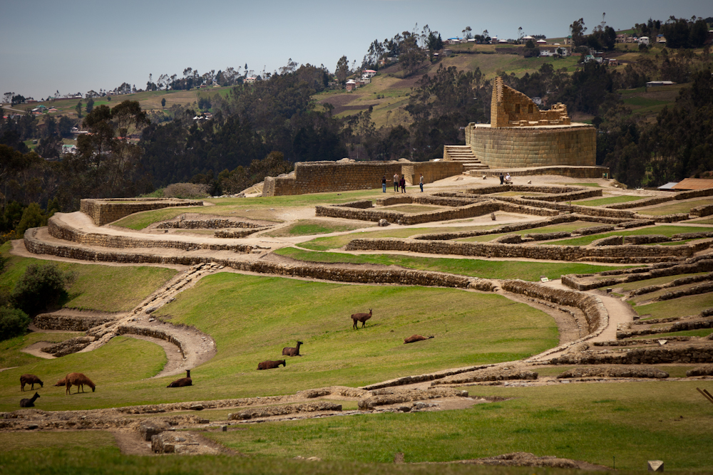
We meandered through the ruins which were very small in comparison to Machu Picchu. The most significant building is the temple of the sun, an elliptically shaped building constructed around a large rock. The building is constructed in the Incan way without mortar. The stones were carefully chiseled and fashioned to fit together perfectly. The temple of the sun was positioned so that on the solstices, at exactly the right time of day, sunlight would fall through the center of the doorway of the small chamber at the top of the temple. Most of this chamber has fallen down.

On the bus back to Cuenca, we met a large Ecuadorian family who were travelling from their home town Azuay to Cuenca to do some shopping.  Our introductions began when the oldest girl in the family sat beside me (Chris was sitting behind me).  She said hello and asked me where I was from.  We then began a little conversation in Spanish where I told here where I was from, my name, my husband’s name, my children’s names, ages, etc.  She introduced me to her two 9-year old cousins who subsequently crowded around us.  The girls’ parents were sitting across the aisle, listening to our conversation, and we were introduced to them as well.  As the conversation continued, the little girls commented on my green eyes and Chris’ blue eyes – it was as if they had never seen eyes like ours before.  Then one of the girls said my hair was pretty, and then she touched it and said it was so soft too.   They were also intrigued by our white skin.  One would have thought they had never seen gringos before!  While this all seemed rather innocent and sweet, it did remind me of our experience in Peru a couple of years ago when Chris and I were also swarmed by sweet looking children on Halloween, only to be robbed by them!  So, as much as I was enjoying the interchange with this lovely family, I was also very much on my guard (as was Chris).   Thankfully, we left the bus with all our belongings intact, but still not sure if our interchange was genuine or opportunistic. I hate thinking like this, but unfortunately it is a necessity in order to protect yourself while travelling.

Today we travelled from Cuenca to Guayaquil via the Cajas National Park on the Alianza bus line.  This was probably the nicest bus we have travelled on, with large, panoramic windows and very comfortable seats.  It would have been worthwhile taking this bus just for the scenery alone. The bus was truly a direct bus, no stopping at all along the way, not even to allow vendors on to sell their wares.  We arrived in 3.5 hrs, a full half hour ahead of schedule.


And so our time in Ecuador has come to an end.  Tomorrow morning we are flying to Arequipa, Peru via Lima.  Originally we had intended on doing this trip by bus, but after researching our options, we decided we would prefer to travel 3,000 km in the comfort and speed of a plane, rather than roughing it on a multi-day bus trip….what can I say, comfort and safety at the expense of adventure is sometimes the more prudent way to go.

Biking in Baños

On Monday, we said our final good-bye to Quito and travelled 4 hours south by bus to Baños.  This small town, nestled in a valley within the Andes in Central Ecuador, is known as the “Gateway to the Amazon” as it is located on the Pastaza River in the Amazon River basin.  The town sits at the base of the largest volcano in Ecuador called Tungurahua, also known as “The Black Giant”. The 5,023 meter-high volcano provides a lush and unique backdrop full of dramatic waterfalls, deep river gorges, and dense vegetation that attracts nature and adventure lovers alike.

This volcano is active;  after a long period of quiescence, the volcano entered an eruptive phase starting in 1999, that is ongoing as of 2011, with major eruptions on 16 August 2006, 6 February 2008, 28 May 2010, 4 December 2010 and 26 April 2011.  This is no trivial matter – even the free tourist map includes the town’s evacuation route in the event of an eruption. The picture to the left captured the magnificent eruption of 1999. This sleeping giant did not awaken during our brief visit to Baños.

In spite of the close proximity to an active volcano that can blow its top at any moment, tourists and locals flock to this region for the plethora of adventure activities available, such as white water rafting, canyoneering (propelling oneself down the side of waterfalls), mountaineering, puenting (more about that later), cycling, horseback riding, and bungee jumping. The small town hosts over 60 tour agencies catering to both adventure and thrill seekers.

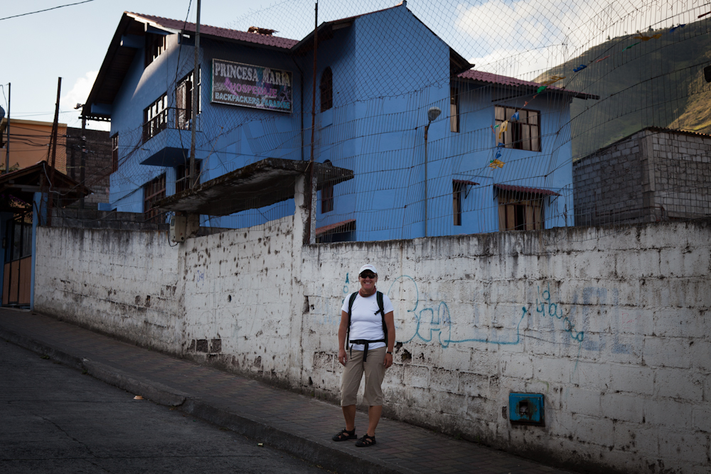
After settling into our hostel, La Princesa Maria (our cheapest accommodation to date at $7 per person per night), the son of the hostel owner graciously offered to give us a tour around town. Within a half an hour we had our bearings and knew where to find the the best restaurants, the tourist office, as well as the grocery store.  We are now regularly making our own food at hostels in an attempt to eat more nutritiously, although it actually costs more this way.  In spite of the cost of the hostel, it was actually very comfortable.

Next on the agenda was to check out some tour agencies to decide how to spend the next day. There were tons of activities and organized tours to choose from. After considering many options, we decided we would rent mountain bikes for the day ($7 each – we splurged an extra two bucks on good equipment, including proper helmets, instead of paying $5 for crappy bikes and no helmets).

On Tuesday, undeterred by the gloomy, cool weather, we left Baños at around 10:00 am via “La Ruta de las Cascadas”, route of the waterfalls.  We were heading towards the town of Puyo, 60km away, just on the edge of the jungle. This route boasts dozens of waterfalls within the first 22km, the highlight being Del Diablo, so named because the rock face looks like the devil.  The majority of this newly paved road is downhill with intermittent uphill sections that provided just enough of a challenge. As we headed out of town, we were in awe of the stunning scenery all around us.

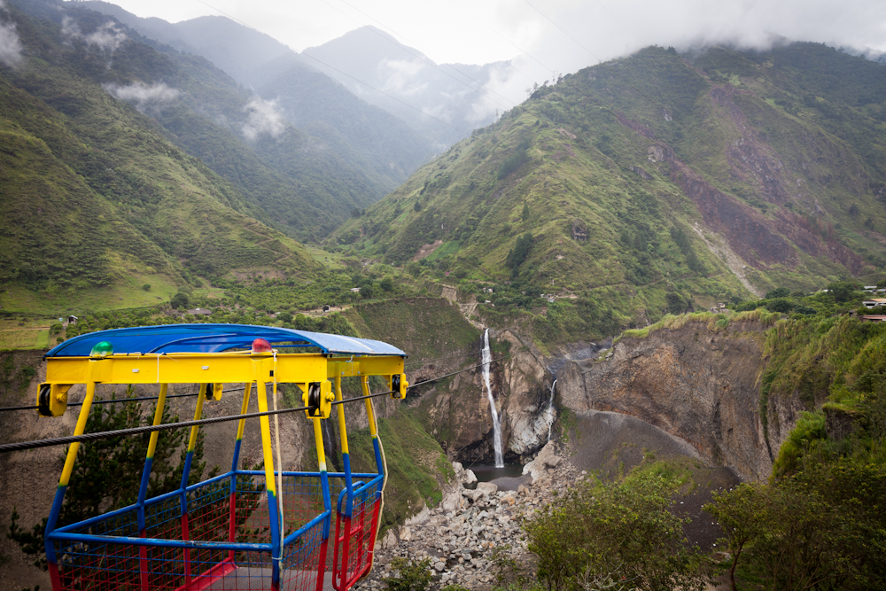
Within a half hour, it started to rain. We pulled over at the next waterfalls just as the rain turned into a downpour.  It just so happened that a “Tarabita” ride as well as zip lining were offered at this location. With memories of the “Tarabita” in Mindo still fresh in my mind, there was no way I was going to do it again, especially if I didn’t have to get to the other side.  But lots of other people were willing to give it a try.  We stayed dry under a sheltered area and watched the zip liners and the “Tarabita”.

As for zip lining, well, I've done that before and had fun doing it, but this took zip lining to a whole new level as you can see from the video below. As we waited out the rain under cover, we watched the zip liners plunge fearlessly towards the deep gorge; even a 60-year old grandmother joined in the fun!
 

Just when we were beginning to wonder if our cycling day was bust, the rain came to a stop and the sun even peaked out a bit.  This was our cue to get on our bikes and get moving.  As we continued to the next waterfalls, we navigated the roads carefully.  We shared the road with regular traffic – cars, trucks, buses, transports – which was a little nerve racking at times.  Ecuadorian drivers seem to be in a rush and are always trying to pass the guy in front.  And they show a blatant disregard for the number of lanes on a road – for instance, it is not uncommon to see 3 or even 4 cars all passing each other in opposite directions on a two-lane road.  You need nerves of steel, especially on a bike. And you need to focus, as there was a steep, concrete ditch on the edge of the road.  One misstep would land you in some pretty serious trouble.

Along the way were tunnels carved right into the mountainside.  After the first tunnel which we went through on our bikes, there were side roads that circumvented the tunnel, especially designed for bikes and smaller vehicles.  These side roads proved to offer some of the best views along the way.  We took our time, stopping often to take pictures.  Everywhere you turned was a perfect picture.

As we passed over a bridge, we stopped to watch a guy getting ready to go “puenting”, which literally translated means “bridging”.  Similar to bungee jumping, yet different in that after you have jump off the bridge and experience the free fall, there is no bounce like in bungee jumping.  You swing from side to side.  Jumpers are hooked up to a harness around their shoulders and legs. From there they are connected to a number of ropes and carabineers. The ropes are set up in a way that there are braking mechanisms that allow for the swing as opposed to the bounce.  Apparently, this extreme sport began as an exercise to help rock climbers overcome their fear of falling.  It is now a very popular sport amongst thrill seekers looking for an adrenaline rush.

We watched in anticipation, not quite sure where the guy was going to fall.  As he jumped off the bridge, my heart practically stopped as he did a free fall towards the rocky river below.  The local guys were cajoling Chris and I and a few other cyclists (who just happened to be Canadian) to give it a try. Not a chance!  But, I did learn a new Spanish word, loco, which means crazy.

When we reached the Del Diablo waterfall, we locked up our bikes and hiked down to the base of the waterfall through humid, moist jungle-like vegetation.  The thunderous waterfall was deafening, reminding me of Niagara Falls.  It was possible to crawl through a narrow path to stand behind the waterfalls – pretty cool, and wet too!  By now, it was mid-afternoon and the sun was out in full force. It was sweltering.

After hiking back to the top, we were pretty hot and tired.  How convenient to find a truck offering trips back to town, bikes and all, for $1.50 per person.  A total of nine cyclists took advantage of the offer.


Since we still had some time left, we toured around town on our bikes and found the location of the infamous natural hot springs and thermal baths for which the town is named.  After dropping off our bikes, we walked around town checking out the Basilica, the artisan market, and the main square.  Then we stopped to soak in the sunshine and do some people watching while enjoying an icy, cold beer on a patio.

After supper, we indulged in the therapeutic waters of the Piscinas de La Virgen where the pools are naturally heated and infused with high amounts of minerals by the volcano, reputed to offer many health benefits and healing powers.   Three pools were available: one that was steaming hot, one that was frigid cold and one that was just right.  We cycled (no pun intended) between the three pools for about an hour and left feeling simultaneously relaxed and refreshed.  Sleep was not far off for me that night.

Note:  I added a video clip to the last blog posting about our hike to Cotopaxi.  I think Chris did a great job capturing the essence of the hike on video.

Third time’s a charm

After two failed attempts due to illness (first Chris and then myself), we finally hiked Cotopaxi on Sunday.  Before I share the details of that excursion, I think I should provide an update on my health as some of you may be wondering what happened after my visit to the doctor earlier in the week.  On Thursday morning, I had a colonoscopy performed at the Clinica Pinchincha by Dr. Coba, the doctor recommended by our friends Eduardo and Paolo.  I had to fast for 24 hours in advance and induce a colon cleansing by drinking a horrid concoction that tasted a lot like Buckley’s Cough Syrup; imagine drinking a bottle of Buckley’s in one sitting. It was all I could do to keep the stuff down and not throw it up. For me, that was the worse part of the whole experience.

When I arrived at the clinic on Thursday morning, I was immediately advised to get into a hospital gown and was then put on a guerney and wheeled into a surgical room.  Keep in mind that while the doctor speaks very good English, the hospital staff do not speak a word and there was no sign of the doctor at this point.  A team of 4 got to work hooking me up to: the automatic blood pressure machine, the oxygen (with the plastic oxygen tubes in my nose), the cardio machine (with the electrodes attached to my chest), a blood oxygen and pulse sensor on my finger tip, and an intravenous line.  As I lay there being poked and prodded, I wondered if there was a mix-up – was I perhaps confused with a patient requiring open heart surgery.  From what I knew of the procedure and how it was done in Canada, this prep seemed a little excessive.  My knowledge of Spanish medical terminology is zero, so I was quite helpless to ask questions.  The only thing I could think of was to ask if Dr. Coba had arrived.  I figured as long as I had the right doctor, then I had a pretty good chance that the right procedure would be performed.  Sure enough, Dr. Coba arrived with the anestesiologist who subsequently administered enough anesthetics to completely knock me out.  The next thing I knew, I was waking up in recovery, listening to the doctor explaining to Chris how everything went.

The colonoscopy revealed a healthy colon, with some small internal hemorrhoids.   In the doctor’s office the next day, Dr. Coba suggested the hemorrhoids may have been the culprit for the bleeding, but he speculated that it was probably a bacterial infection that was cleared up from the round of antibiotics I had taken the previous week.  Either way, he said my colon was healthy and he saw no reason for us not to continue our travels. He provided a written medical report, complete with colour photos and a DVD – relax, I’m not going to include any video clips here, but at least I have proof that they indeed performed a colonoscopy while I was under. One more thing, the insurance folks acquiesced to Chris’ logical arguments for coverage and advised us the colonoscopy and associated costs would indeed be covered. On Monday, we found the Post Office and sent a package of documentation and receipts by registered mail. I hope it reaches its intended destination!

So with that out of the way, we arranged to hike Cotopaxi on Sunday with a private guide, Henry. We left early in the morning under grey skies, but with surprisingly good visibility.  As we travelled 2 hours south on the Panamerica Highway, along “Volcano Avenue”, Henry pointed out the names and heights of the various volcanoes.  We learned there are 79 volcanoes in Ecuador, of which 12 are currently active. Cotopaxi is the highest active volcano at 5897m. It is a stratovolcano (very similar to Mt. Fuji or Mt. Sashta) with an almost perfect symmetrical cone, rising from a highland plain of 3800m and covered by a mighty glacier starting at a height of 5000m. The side of the cone has deep valleys scoured by lahars. The summit crater is 600m x 800m in diameter and several hundred meters deep.   The last recorded eruption occurred in 1904 and in 1975 the volcano awoke for a short time but did not produce any spectacular events. In the last few years fumarolic activities and sulfuric emissions increased and ice around the inside rim and on the southeastern side of the cone started to melt away.  We figured we were pretty safe that an eruption would not occur while we were hiking.

Originally we considered doing a two-day summit trek, something we have never done before.  After seeing the groups on the mountain preparing for that trek, I honestly don’t know what we were thinking.  Let’s just say that as we approached this majestic, daunting volcano, we were both happy with our decision to just do a single day hike.  This mountain was big, and the trek to the summit required skills, gear and clothing we simply did not possess. I’m glad we realized this earlier rather than later.

We entered the south entrance of the park which is supposed to have a better road than the north entrance.  We travelled about 15 km along the worst road we have ever been on until the car could simply go no further.  Literally. Chris even tried to push it but to no avail.  The loose dirt road resembled a ski hill with advanced mogels making it completely impassable, unless you were in a 4-wheel drive, which we were not.   So that was that.  Out we got, and started our hike well below the designated trail head.

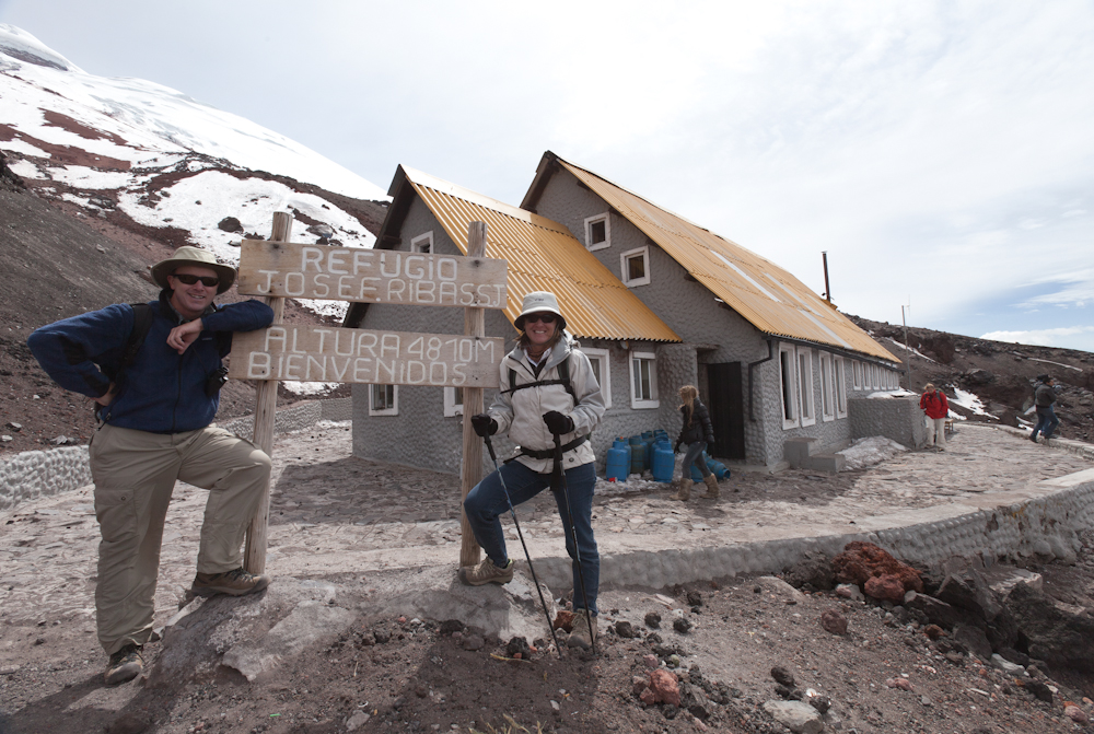
Our hike began at an altitude of approximately 3800m – already 1000m above the altitude in Quito.  Our goal was to hike to the start of the glacier, at about 5000m. Normally, you would want to acclimatize a bit before the ascent, but our guide recommended we start right away while the visibility was still good. So off we went.  This was a difficult hike.  It was a vertical climb, increasing our altitude with every step.  At 4,400m, I was struggling.  I felt light headed and weak in the knees.  My heart was racing.  We slowed our pace to a crawl, and stopped regularly to let our heart rate settle.  It felt like we were sprinting around the block, pausing to catch our breath, only to sprint again – yet we were walking at a snail’s pace.  I was more than happy to wait for Chris whenever he stopped to take a photo.

As we ascended, the wind howled incessantly and the temperatures dropped.  I bundled up with my wind breaker, headband and light mitts.  At 4800m, we reached the refugio which is a building that serves as a rest station for both day and summit hikers alike. We had a simple sandwich and a cup of steaming hot chocolate to warm us up. This reminded me of drinking hot chocolate while skating on the canal in Ottawa in the winter.

From the refugio, it was another 200 vertical metres to the glacier.  At this point, I was feeling really good.  I seemed to have acclimatized quite quickly and was no longer feeling light headed. Chris, on the other hand, who was feeling fine to this point, started to deteriorate as we began our ascent to the glacier.

We went very slowly and 30 minutes later we finally made it – just under 5000m – the highest elevation we have ever reached.  We were rewarded with stunning, panoramic vistas.

After lots of photos, we began our descent, choosing a direct, but more vertical route.  It was rather treacherous as we slipped and slid our way down the mountain side along the loose gravel trail, falling more than a few times.  We were happy to reach the car, satisfied that we had finally hiked Cotopaxi.


Slideshow from Cotopaxi
%%wppa%%
%%slide=1%%
%%size=400%%